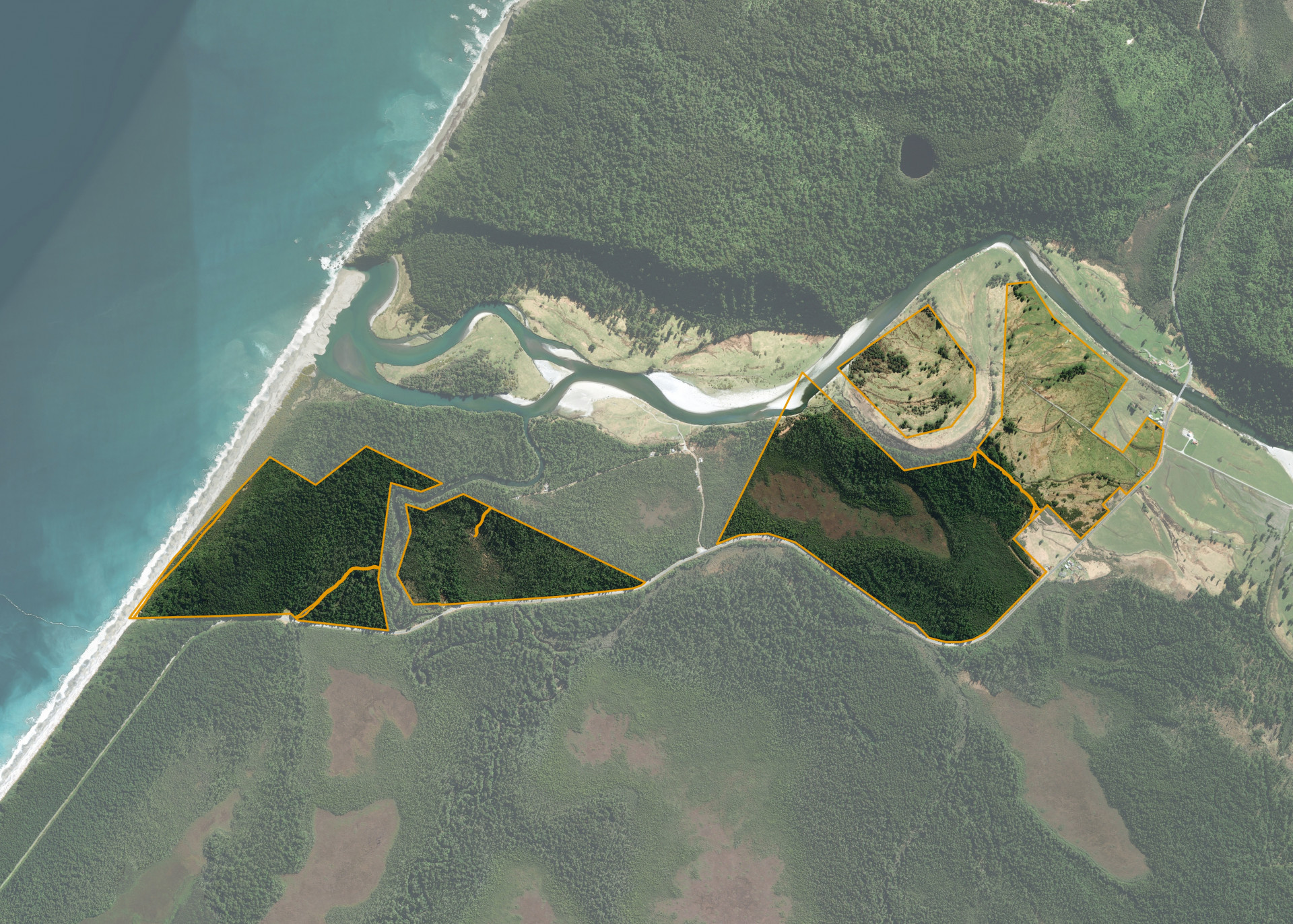
Bruce Bay 853, 854 & 855B
Bruce Bay 853, 854 & 855B is a 220.9570 hectare property situated on State Highway 6, Makawhio River, Bruce Bay. The land is level in contour and has a northerly aspect. The block has highway frontage 300m south of the Jacobs River bridge.
The effective area, approximately 60 hectares, was previously utilised for beef cattle and dairy grazing. The balance of the land can be attributed to heavy bush and swamp.
There are a set of cattle yards on the property.
Land Information
- Land area:
- 220.957 hectares
- Location:
- On State Highway 6, Makawhio River
- Region:
- West Coast
- Māori Land Court region:
- Te Waipounamu
- Role of Māori Trustee for this whenua:
- Responsible Trustee
Learn more about the role of the Māori Trustee.
Owner Information
There are 321 people or whānau trusts who have shares in Bruce Bay 853, 854 & 855B.
Find individual owners or whānau trusts for this whenua
Tip: Search by first name
If you have a question about this whenua or you want to update your details please contact us.
Find out about upcoming owner hui for this whenuaStay connected with My Whenua
My Whenua is our online service for owners, trustees, whānau and those with a connection to whenua we look after on their behalf.
It’s a way to stay up to date with information about your whenua, including:
- Maps and photos
- Owner reports
- A list of owners
- Minutes of owner hui, and more.