Rangitaiki 217
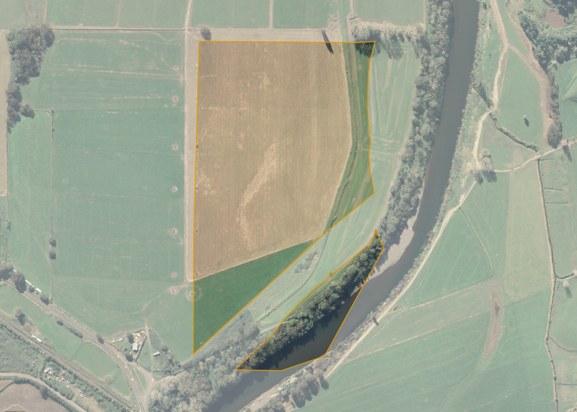
Rangitaiki 217 is a 16.2270 hectare property situated on White Pine Bush Road, approximately 12 kilometres from Whakatane. The property is separated into two sections by an unformed legal road. The land is flat in contour and has an open aspect.
Soils on the property comprise of layered river silt and fine sandy loam from successive flood events of the Whakatane River. The unformed legal road provides access onto formed White Pine Bush Road from which the block can be accessed from.
The effective area, approximately 12.62 hectares, is currently utilised for growing annual ryegrass or maize for silage. The balance of the land can be attributed to the area that is no longer utilised by the lessee and the stop bank and river berm.
Land Information
- Land area:
- 16.227 hectares
- Location:
- White Pine Bush Road, Whakatane
- Region:
- Bay of Plenty
- Māori Land Court region:
- Waiariki
- Role of Māori Trustee for this whenua:
- Responsible Trustee
Learn more about the role of the Māori Trustee.
Owner Information
There are 75 people or whānau trusts who have shares in Rangitaiki 217.
Find individual owners or whānau trusts for this whenua
Tip: Search by first name
If you have a question about this whenua or you want to update your details please contact us.
Find out about upcoming owner hui for this whenuaStay connected with My Whenua
My Whenua is our online service for owners, trustees, whānau and those with a connection to whenua we look after on their behalf.
It’s a way to stay up to date with information about your whenua, including:
- Maps and photos
- Owner reports
- A list of owners
- Minutes of owner hui, and more.