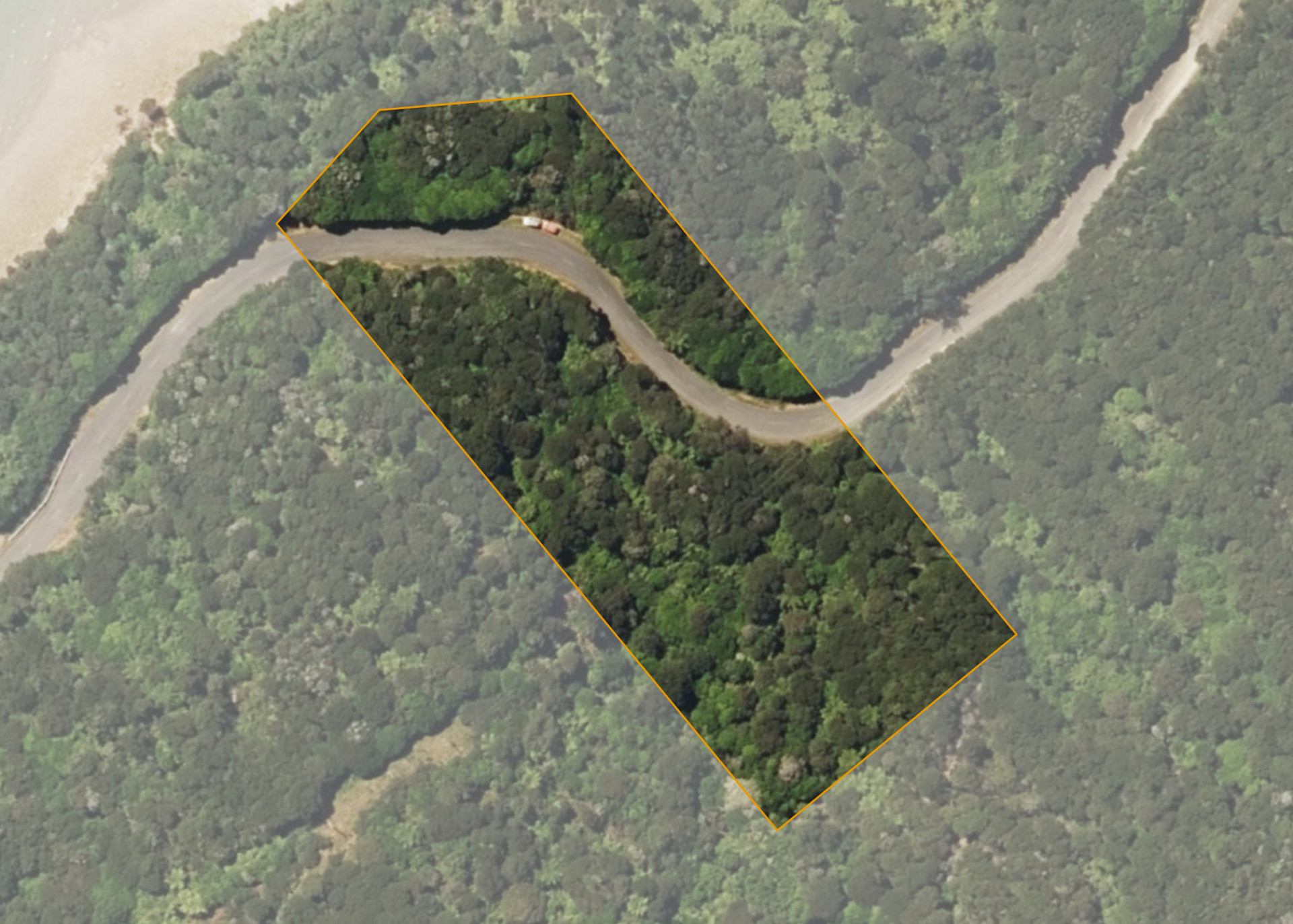
Kenepuru Blk II Section 12
Kenepuru Blk II Section 12 is a 1.2141 hectare property situated on Kenepuru Road, Sandy Bay, approximately 60 kilometres from Picton. The land is split by Kenepuru Road into two severances. The northern severance slopes down from the road and the southern severance rises from the road to the rear of the property. The fronts Kenepuru Road.
The block is currently vacant and covered in dense bush and scrub.
Land Information
- Land area:
- 1.2141 hectares
- Region:
- Marlborough
- Māori Land Court region:
- Te Waipounamu
- Role of Māori Trustee for this whenua:
- Responsible Trustee
Learn more about the role of the Māori Trustee.
Owner Information
There are 88 people or whānau trusts who have shares in Kenepuru Blk II Section 12.
Find individual owners or whānau trusts for this whenua
Tip: Search by first name
If you have a question about this whenua or you want to update your details please contact us.
Find out about upcoming owner hui for this whenuaStay connected with My Whenua
My Whenua is our online service for owners, trustees, whānau and those with a connection to whenua we look after on their behalf.
It’s a way to stay up to date with information about your whenua, including:
- Maps and photos
- Owner reports
- A list of owners
- Minutes of owner hui, and more.