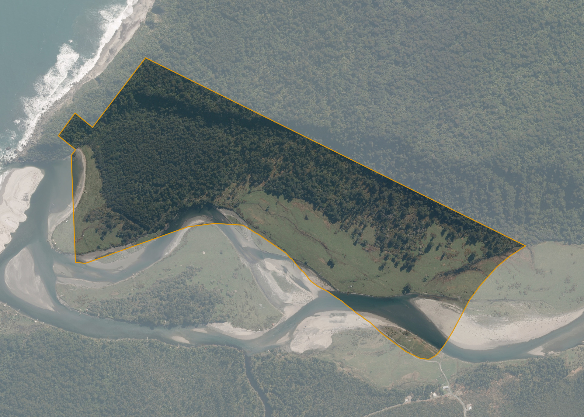
Bruce Bay 786
Bruce Bay 786 is a 64.7497 hectare property situated at Jacobs River, just north of State Highway 6 and 6 kilometres north of Bruce Bay.
Access to the land is from the highway into Section 785 on the south side of the river only. A river crossing is required to access the majority of the block.
The effective area, approximately 20 hectares of open river flats, are currently utilised for grazing beef cattle and are located on the northern side of Jacobs River.
Land Information
- Land area:
- 64.7497 hectares
- Location:
- At Makawhio River Mouth, Jacobs River
- Region:
- West Coast
- Māori Land Court region:
- Te Waipounamu
- Role of Māori Trustee for this whenua:
- Responsible Trustee
Learn more about the role of the Māori Trustee.
Owner Information
There are 134 people or whānau trusts who have shares in Bruce Bay 786.
Find individual owners or whānau trusts for this whenua
Tip: Search by first name
If you have a question about this whenua or you want to update your details please contact us.
Find out about upcoming owner hui for this whenuaStay connected with My Whenua
My Whenua is our online service for owners, trustees, whānau and those with a connection to whenua we look after on their behalf.
It’s a way to stay up to date with information about your whenua, including:
- Maps and photos
- Owner reports
- A list of owners
- Minutes of owner hui, and more.