Aorangi 3G 2B 6
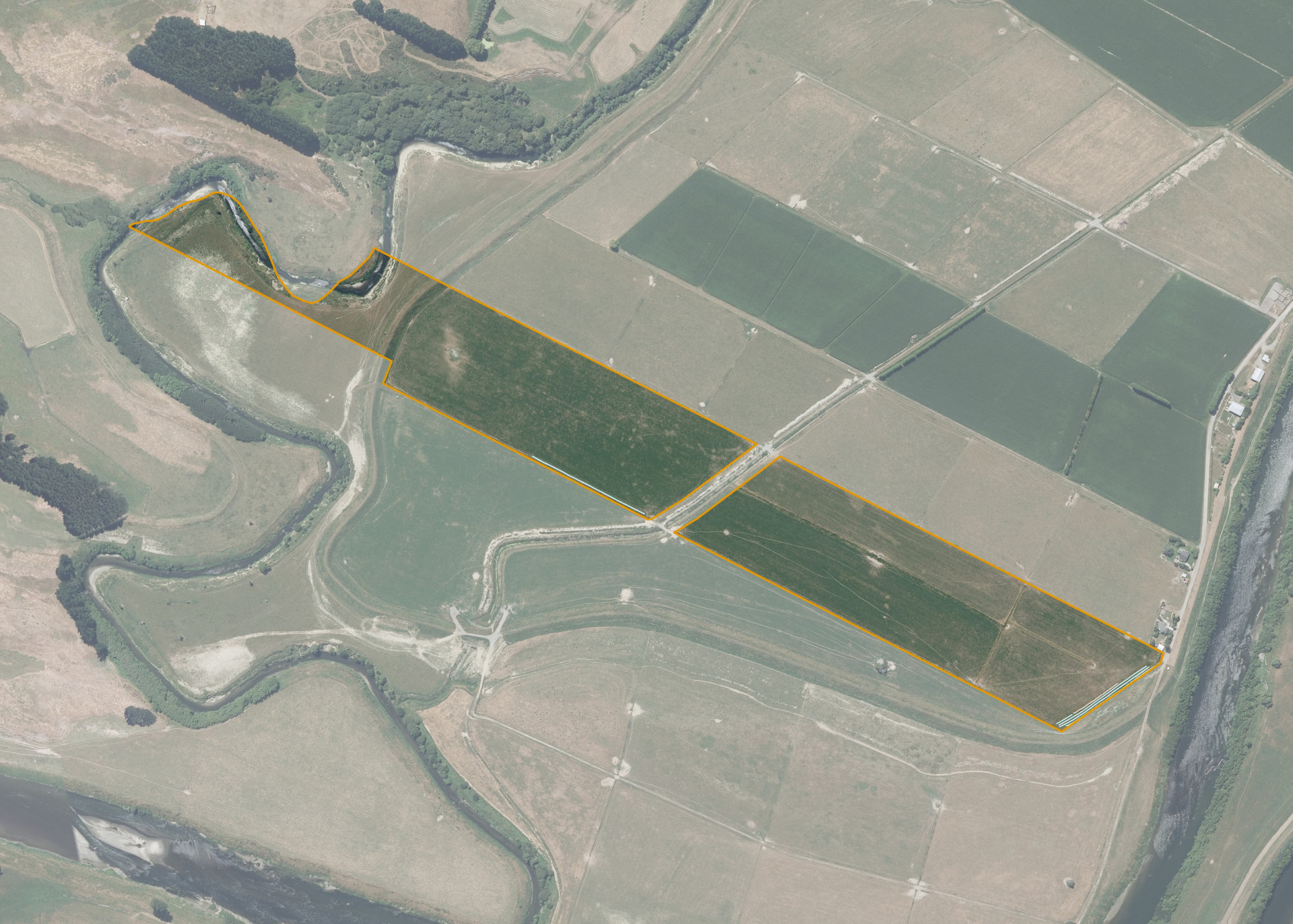
Aorangi 3G 2B 6 is a 14.8797 hectare property situated at the end of Riverbank Road, Rangiotu, and is approximately 15 kilometres south-west of Palmerston North. The land is flat in contour and has an open aspect. The block can be accessed from Riverbank Road.
The leased area 11.9776 hectares, is currently utilised for dairy grazing and cropping in conjunction with the lessee's adjoining land. The balance of the land can be attributed to drains on the property.
Land Information
- Land area:
- 14.8797 hectares
- Location:
- Riverbank Road, Rangitoto
- Region:
- Manawatu / Whanganui
- Māori Land Court region:
- Aotea
- Role of Māori Trustee for this whenua:
- Responsible Trustee
Learn more about the role of the Māori Trustee.
Owner Information
There are 37 people or whānau trusts who have shares in Aorangi 3G 2B 6.
Find individual owners or whānau trusts for this whenua
Tip: Search by first name
If you have a question about this whenua or you want to update your details please contact us.
Find out about upcoming owner hui for this whenuaStay connected with My Whenua
My Whenua is our online service for owners, trustees, whānau and those with a connection to whenua we look after on their behalf.
It’s a way to stay up to date with information about your whenua, including:
- Maps and photos
- Owner reports
- A list of owners
- Minutes of owner hui, and more.