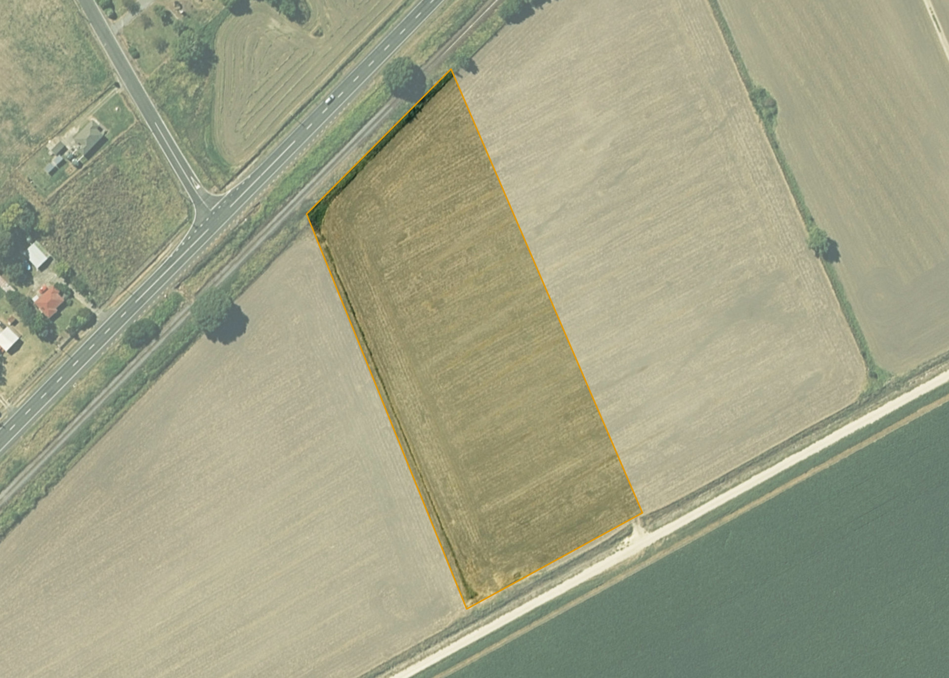
Te Aute 5D
Te Aute 5D is a 1.8019 hectare property situated on State Highway 2, approximately 23 kilometres from Hastings. The land is flat in contour. The block is landlocked and is currently accessed via adjoining land.
The block is currently leased together with Te Aute 5C2 and 5E. The properties form a 9.3559 hectare property, of which, 8.7037 hectares is effective and is utilised for arable cropping. The balance of the land can be attributed to the small northern severance at the eastern end that is considered ineffective.
Land Information
- Land area:
- 1.8109 hectares
- Location:
- State Highway 2, Te Hauke
- Region:
- Hawkes Bay
- Māori Land Court region:
- Takitimu
- Role of Māori Trustee for this whenua:
- Responsible Trustee
Learn more about the role of the Māori Trustee.
Owner Information
There are 15 people or whānau trusts who have shares in Te Aute 5D.
Find individual owners or whānau trusts for this whenua
Tip: Search by first name
If you have a question about this whenua or you want to update your details please contact us.
Find out about upcoming owner hui for this whenuaStay connected with My Whenua
My Whenua is our online service for owners, trustees, whānau and those with a connection to whenua we look after on their behalf.
It’s a way to stay up to date with information about your whenua, including:
- Maps and photos
- Owner reports
- A list of owners
- Minutes of owner hui, and more.