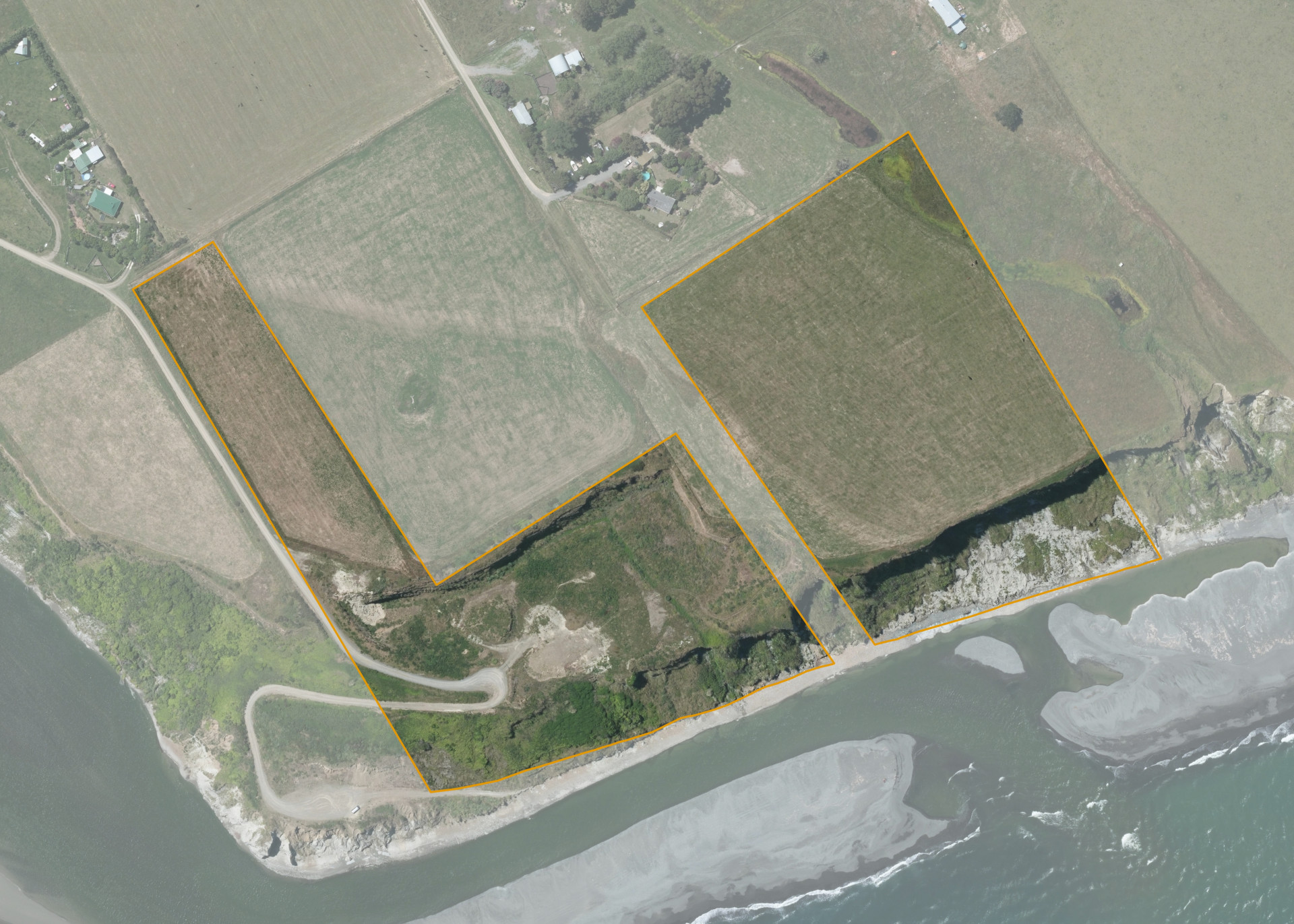
Waipapa A122
The land comprises two severances, one situated at the end of Church Lane, comprising 4.3251 hectares more or less. The second is situated at the end of East Beach Road comprising 3.5284 hectares more or less.
Both severances have coastal eastern boundaries.
The grazing lease pertains to the 4.3 hectares Church Lane severance and .09 hectares of the East Beach Road severance. Of the leased area, 4 hectares is effective, with the remainder of the land being lost to the Oceanside cliff. This land area is flat in contour to the steep cliff face at the beach.
A metal extraction grant to Quality Roading Services (Wairoa) Limited expired on 31 December 2016, this grant allowed a quarry to operate on the majority of the southern severance with a pit area of approximately 3.00 hectares.
Land Information
- Land area:
- 7.8534 hectares
- Location:
- Mohaka Road, Mohaka
- Region:
- Hawkes Bay
- Māori Land Court region:
- Tairawhiti
- Role of Māori Trustee for this whenua:
- Responsible Trustee
Learn more about the role of the Māori Trustee.
Owner Information
There are 88 people or whānau trusts who have shares in Waipapa A122.
Find individual owners or whānau trusts for this whenua
Tip: Search by first name
If you have a question about this whenua or you want to update your details please contact us.
Find out about upcoming owner hui for this whenuaStay connected with My Whenua
My Whenua is our online service for owners, trustees, whānau and those with a connection to whenua we look after on their behalf.
It’s a way to stay up to date with information about your whenua, including:
- Maps and photos
- Owner reports
- A list of owners
- Minutes of owner hui, and more.