Rangiwaea 4F 16 3B4
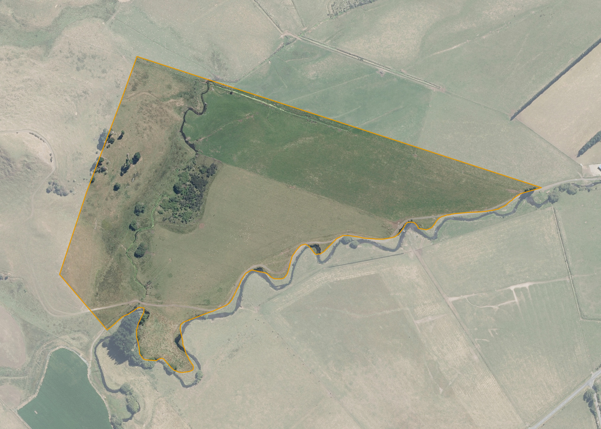
Rangiwaea 4F 16 3B4 is a 28.0497 hectare property situated on the southern side of State Highway 49, approximately 10 kilometres south-east of Ohakune. The land is flat to easy rolling in contour. The block is landlocked and is currently accessed via the lessee's neighbouring farm.
The effective area, approximately 24.6 hectares, is currently utilised for sheep and beef pastoral farming. The balance of the land can be attributed to scrub, the small creek and the riparian borders on the watercourse.
Land Information
- Land area:
- 28.0497 hectares
- Location:
- Whangaehu Valley Road, Ohakune
- Region:
- Manawatu / Whanganui
- Māori Land Court region:
- Aotea
- Role of Māori Trustee for this whenua:
- Responsible Trustee
Learn more about the role of the Māori Trustee.
Owner Information
There are 80 people or whānau trusts who have shares in Rangiwaea 4F 16 3B4.
Find individual owners or whānau trusts for this whenua
Tip: Search by first name
If you have a question about this whenua or you want to update your details please contact us.
Find out about upcoming owner hui for this whenuaStay connected with My Whenua
My Whenua is our online service for owners, trustees, whānau and those with a connection to whenua we look after on their behalf.
It’s a way to stay up to date with information about your whenua, including:
- Maps and photos
- Owner reports
- A list of owners
- Minutes of owner hui, and more.