Karaka C1A
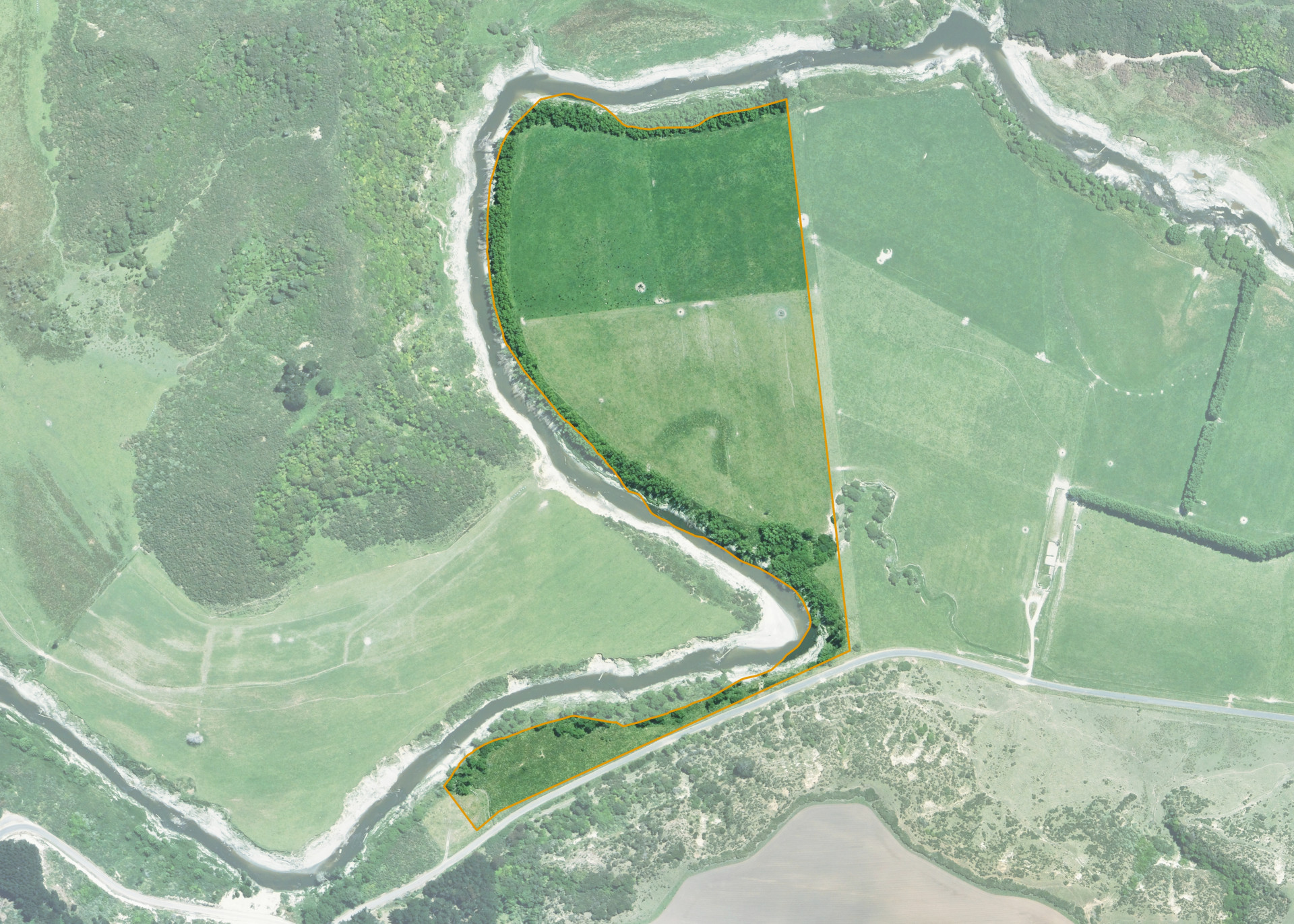
Karaka C1A is a 17.3509 hectare property situated on Waitotara Valley Road, approximately 5 kilometres north of the Waitotara Township. The land is flat running to low riverbank sidling bounding the Waitotara River and has an open aspect. Soils on the property comprise of Kairanga silt loam. The block can be accessed from Waitotara Valley Road.
The effective area, approximately 15.00 hectares, is currently utilised for cattle grazing/finishing. The balance of the land can be attributed to the retired riverbank planted with willow for riverbank protection.
Land Information
- Land area:
- 17.3509 hectares
- Location:
- Waitotara Valley Road, Waitotara
- Region:
- Taranaki
- Māori Land Court region:
- Aotea
- Role of Māori Trustee for this whenua:
- Responsible Trustee
Learn more about the role of the Māori Trustee.
Owner Information
There are 151 people or whānau trusts who have shares in Karaka C1A.
Find individual owners or whānau trusts for this whenua
Tip: Search by first name
If you have a question about this whenua or you want to update your details please contact us.
Find out about upcoming owner hui for this whenuaStay connected with My Whenua
My Whenua is our online service for owners, trustees, whānau and those with a connection to whenua we look after on their behalf.
It’s a way to stay up to date with information about your whenua, including:
- Maps and photos
- Owner reports
- A list of owners
- Minutes of owner hui, and more.