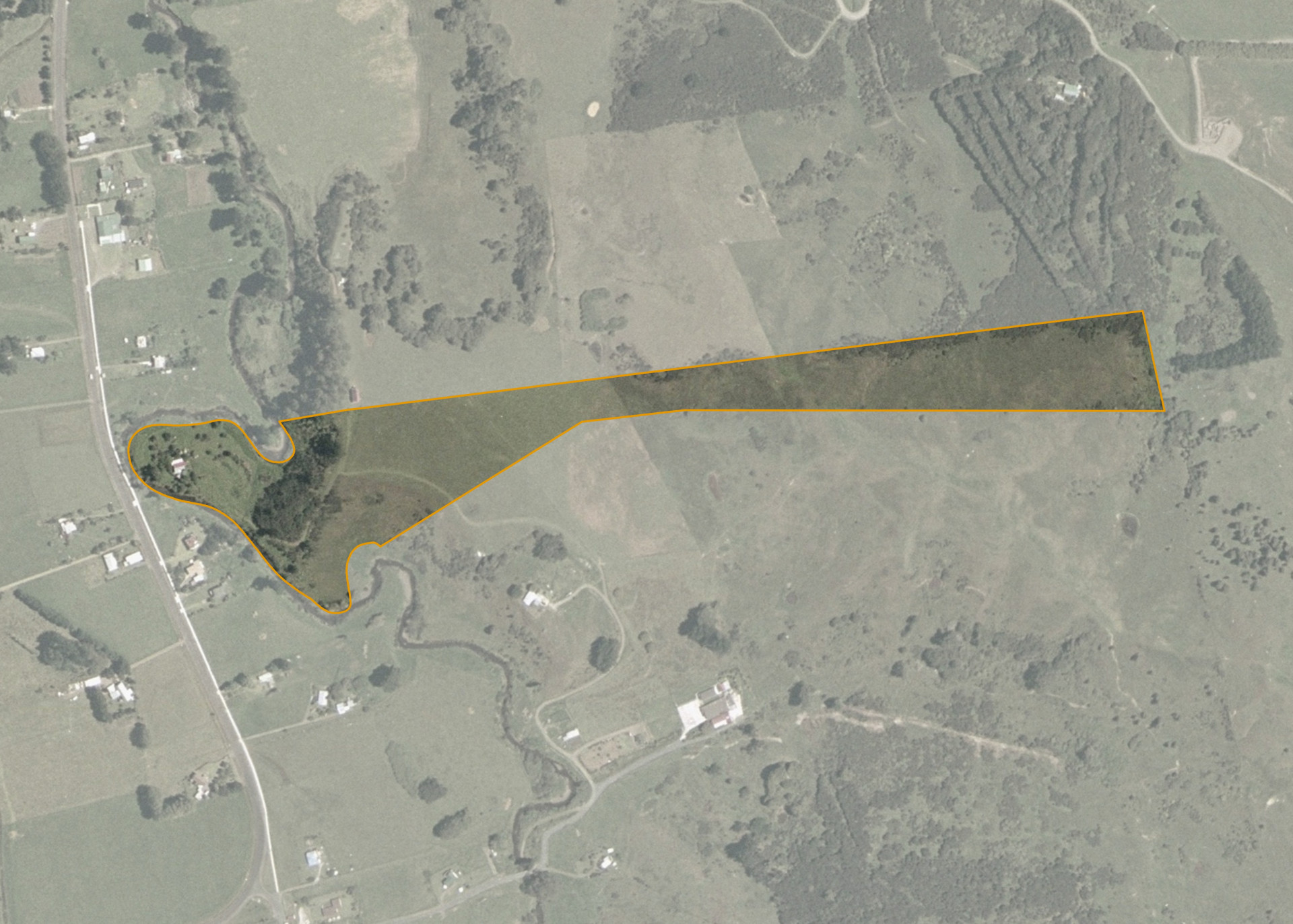
Whirinaki 5E Pt
Whirinaki 5E Pt is a 9.35 hectare property and is situated in the small rural settlement of Whirinaki, 43 km west of Kaikohe on State Highway 12.
The land is of an irregular shape being over 1000 metres long and 37 metres wide. The land has a contour of flat to medium.
Land Information
- Land area:
- 9.5227 hectares
- Location:
- State Highway 12, Kaikohe
- Region:
- Northland
- Māori Land Court region:
- Taitokerau
- Role of Māori Trustee for this whenua:
- Other
Learn more about the role of the Māori Trustee.
Owner Information
There are 141 people or whānau trusts who have shares in Whirinaki 5E Pt.
Find individual owners or whānau trusts for this whenua
Tip: Search by first name
If you have a question about this whenua or you want to update your details please contact us.
Find out about upcoming owner hui for this whenuaStay connected with My Whenua
My Whenua is our online service for owners, trustees, whānau and those with a connection to whenua we look after on their behalf.
It’s a way to stay up to date with information about your whenua, including:
- Maps and photos
- Owner reports
- A list of owners
- Minutes of owner hui, and more.