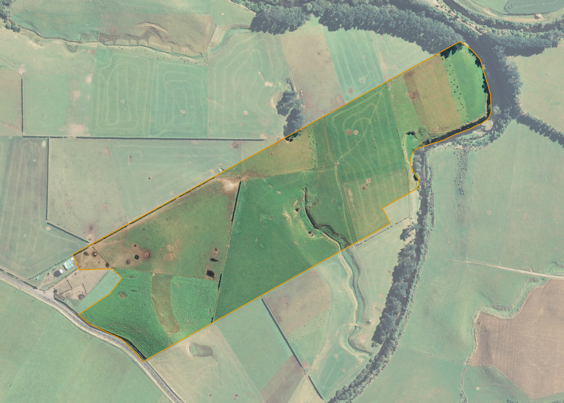
Inuawai 1C 2B
Inuawai 1C 2B is an 18.9266 hectare property situated on the north-eastern side of Mawhitiwhiti Road, approximately 12 kilometres north-west of Hawera. The land contour is a mix of elevated top flats with a medium steep hill and bottom flats. The block is currently accessed through the lessee's stockyards.
The effective area, approximately 18.2166 hectares, is currently utilised for bull beef farming in conjunction with the lessee's neighbouring farm. The balance of the land can be attributed to the riparian area.
Land Information
- Land area:
- 18.9266 hectares
- Location:
- Mawhitiwhiti Road, Normanby
- Region:
- Taranaki
- Māori Land Court region:
- Aotea
- Role of Māori Trustee for this whenua:
- Responsible Trustee
Learn more about the role of the Māori Trustee.
Owner Information
There are 57 people or whānau trusts who have shares in Inuawai 1C 2B.
Find individual owners or whānau trusts for this whenua
Tip: Search by first name
If you have a question about this whenua or you want to update your details please contact us.
Find out about upcoming owner hui for this whenuaStay connected with My Whenua
My Whenua is our online service for owners, trustees, whānau and those with a connection to whenua we look after on their behalf.
It’s a way to stay up to date with information about your whenua, including:
- Maps and photos
- Owner reports
- A list of owners
- Minutes of owner hui, and more.