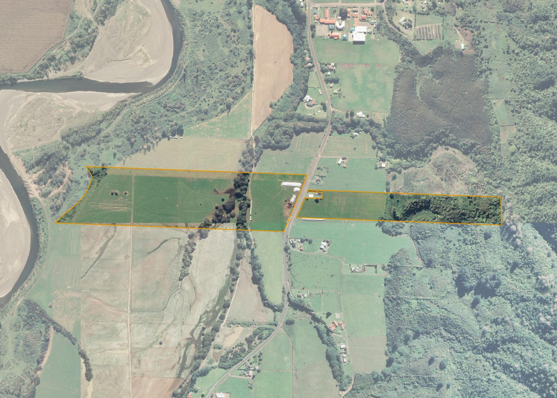
Ruatoki A26B
Ruatoki A26B is an 18.0666 hectare property situated on Ruatoki Valley Road, approximately 10.2 kilometres from Taneatua. The land is flat to undulating in contour and is split into two severances by Ruatoki Valley Road. The block can be accessed from both Ruatoki Valley Road and via the lessee's adjoining land.
The effective area, approximately 12.7 hectares, is currently utilised for milking of dairy cows and making supplementary feed. The balance of the land can be attributed to bush, scrub, creeks and the river berm.
Land Information
- Land area:
- 18.0666 hectares
- Location:
- 195 Ruatoki Valley Road, Ruatoki
- Region:
- Bay of Plenty
- Māori Land Court region:
- Waiariki
- Role of Māori Trustee for this whenua:
- Responsible Trustee
Learn more about the role of the Māori Trustee.
Owner Information
There are 72 people or whānau trusts who have shares in Ruatoki A26B.
Find individual owners or whānau trusts for this whenua
Tip: Search by first name
If you have a question about this whenua or you want to update your details please contact us.
Find out about upcoming owner hui for this whenuaStay connected with My Whenua
My Whenua is our online service for owners, trustees, whānau and those with a connection to whenua we look after on their behalf.
It’s a way to stay up to date with information about your whenua, including:
- Maps and photos
- Owner reports
- A list of owners
- Minutes of owner hui, and more.