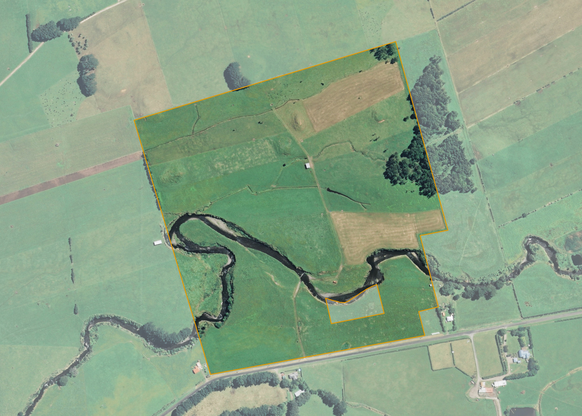
Ngatituhekerangi 16B 2B
Ngatituhekerangi 16B 2B is a 27.8221 hectare property situated on the northern side of Ngariki Road, approximately 5 kilometres south-east of Rahotu. The land is flat to easy in contour with some lahar mounds and is dissected by the Okahu Stream. The block can be accessed from the road.
The property is currently utilised for dairy support.
There is a hay barn, pump shed and a set of stockyards on the property.
Land Information
- Land area:
- 27.8221 hectares
- Location:
- Ngariki Road, Rahotu
- Region:
- Taranaki
- Māori Land Court region:
- Aotea
- Role of Māori Trustee for this whenua:
- Responsible Trustee
Learn more about the role of the Māori Trustee.
Owner Information
There are 60 people or whānau trusts who have shares in Ngatituhekerangi 16B 2B.
Find individual owners or whānau trusts for this whenua
Tip: Search by first name
If you have a question about this whenua or you want to update your details please contact us.
Find out about upcoming owner hui for this whenuaStay connected with My Whenua
My Whenua is our online service for owners, trustees, whānau and those with a connection to whenua we look after on their behalf.
It’s a way to stay up to date with information about your whenua, including:
- Maps and photos
- Owner reports
- A list of owners
- Minutes of owner hui, and more.