Kahuitara 2A3
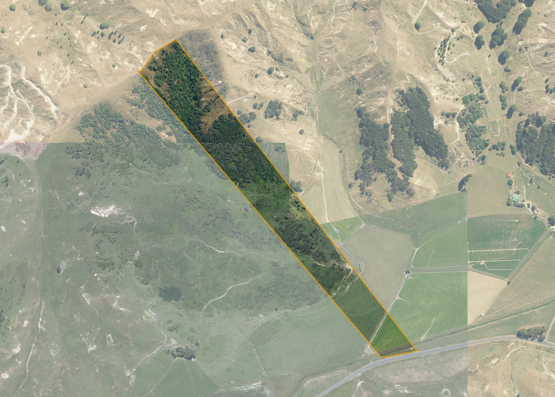
Kahuitara 2A3 is a 12.1253 hectare property situated on State Highway 2, approximately 4 km north of the Wairoa Township. The land is a long narrow section of largely steep broken hill covered in manuka and light bush, with a portion of easy low ridge and approximately 2.5 hectares of flats which are broken by two large open drains. An area of 0.8 hectares of the flat is isolated by the drains and used by the neighbouring property due to access difficulties. The block can be accessed directly from the state highway.
The effective area, approximately 4-5 hectares, is currently utilised for grazing. The balance of the land can be attributed to steep hill in Manuka and light bush.
There are no structures on the property.
Land Information
- Land area:
- 12.1254 hectares
- Location:
- State Highway 2 North, Wairoa
- Region:
- Hawkes Bay
- Māori Land Court region:
- Tairawhiti
- Role of Māori Trustee for this whenua:
- Responsible Trustee
Learn more about the role of the Māori Trustee.
Owner Information
There are 68 people or whānau trusts who have shares in Kahuitara 2A3.
Find individual owners or whānau trusts for this whenua
Tip: Search by first name
If you have a question about this whenua or you want to update your details please contact us.
Find out about upcoming owner hui for this whenuaStay connected with My Whenua
My Whenua is our online service for owners, trustees, whānau and those with a connection to whenua we look after on their behalf.
It’s a way to stay up to date with information about your whenua, including:
- Maps and photos
- Owner reports
- A list of owners
- Minutes of owner hui, and more.