Otautu 13 & 14
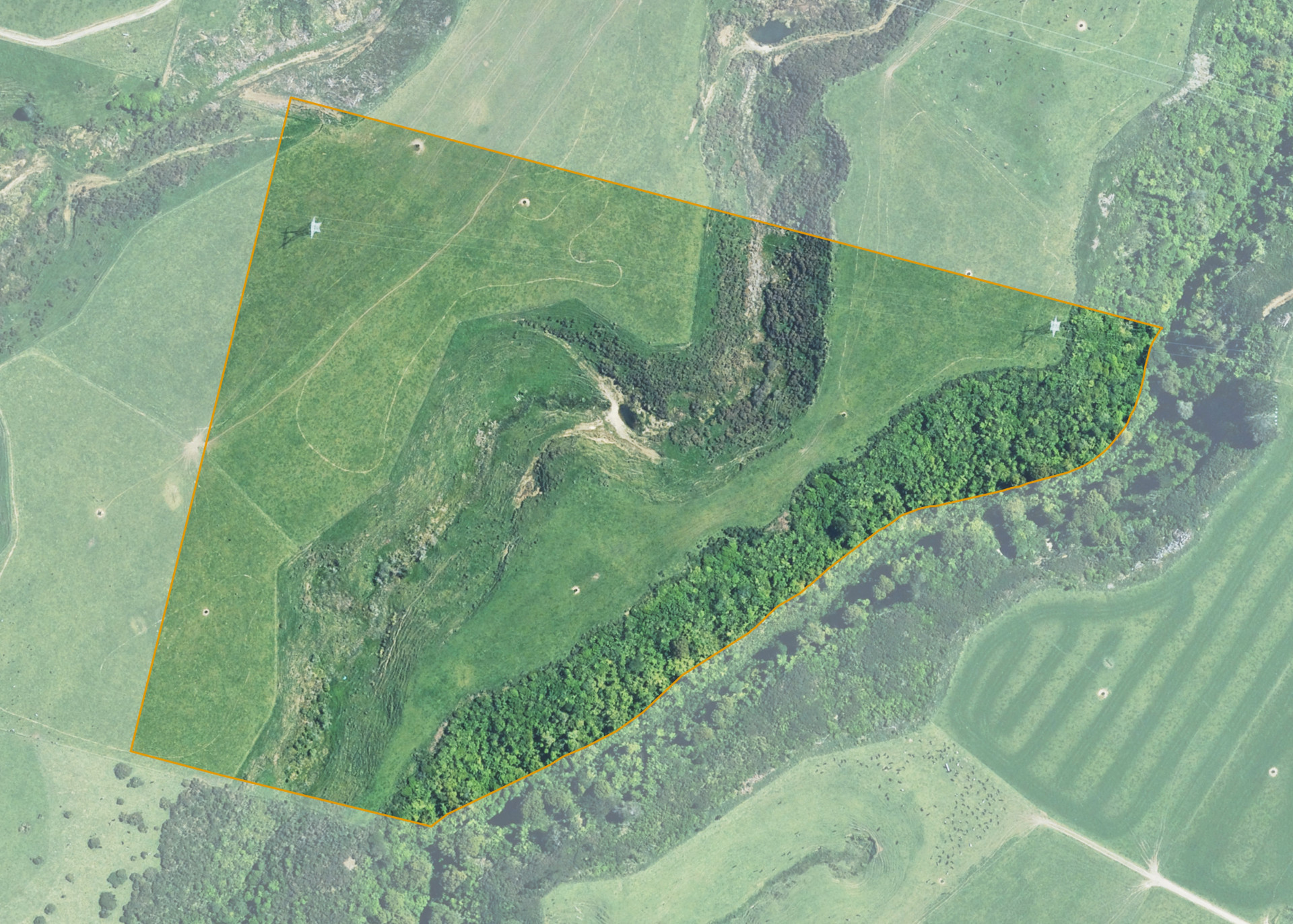
Otautu 13 & 14 is a 13.5570 hectare property situated on the unformed Urekawa Road off Otauto Road, approximately 12 kilometres east of Patea. The land is flat to easy in contour and is split by a gully. The property has a predominantly south facing aspect. The block is landlocked.
Otautu 13 & 14 is currently leased along with Otautu 11. Combined, the blocks total 26.4058 hectares, of which approximately 23.23 hectares is effective and utilised as a dairy platform/run-off. The balance of the land can be attributed to watercourses and bush areas on the blocks.
Land Information
- Land area:
- 13.557 hectares
- Location:
- Otauto Road, Patea
- Region:
- Taranaki
- Māori Land Court region:
- Aotea
- Role of Māori Trustee for this whenua:
- Responsible Trustee
Learn more about the role of the Māori Trustee.
Owner Information
There are 11 people or whānau trusts who have shares in Otautu 13 & 14.
Find individual owners or whānau trusts for this whenua
Tip: Search by first name
If you have a question about this whenua or you want to update your details please contact us.
Find out about upcoming owner hui for this whenuaStay connected with My Whenua
My Whenua is our online service for owners, trustees, whānau and those with a connection to whenua we look after on their behalf.
It’s a way to stay up to date with information about your whenua, including:
- Maps and photos
- Owner reports
- A list of owners
- Minutes of owner hui, and more.