Okurupatu A1B2
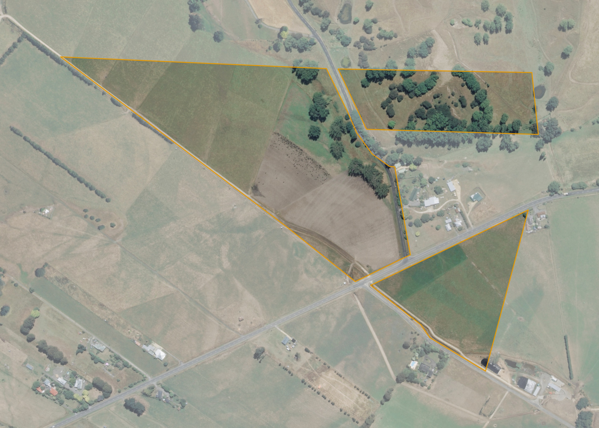
Okurupatu A1B2 is a 22.8040 hectare property situated at the junction of Black Rock Road and Te Ore Ore Bideford Road, approximately 5 kilometres from Masterton. The land is flat to easy hill in contour and is split into three severances by the roads. The block can be accessed from both Black Rock Road and Te Ore Ore Bideford Road.
The block is entirely effective. Two severances are currently utilised for dairying in conjunction with the lessee's dairy unit. The third, north-eastern hill country severance, is currently sub-let to the neighbouring dry-stock farmer.
Land Information
- Land area:
- 22.804 hectares
- Location:
- Black Rock Road, Masterton
- Region:
- Wairarapa
- Māori Land Court region:
- Takitimu
- Role of Māori Trustee for this whenua:
- Responsible Trustee
Learn more about the role of the Māori Trustee.
Owner Information
There are 90 people or whānau trusts who have shares in Okurupatu A1B2.
Find individual owners or whānau trusts for this whenua
Tip: Search by first name
If you have a question about this whenua or you want to update your details please contact us.
Find out about upcoming owner hui for this whenuaStay connected with My Whenua
My Whenua is our online service for owners, trustees, whānau and those with a connection to whenua we look after on their behalf.
It’s a way to stay up to date with information about your whenua, including:
- Maps and photos
- Owner reports
- A list of owners
- Minutes of owner hui, and more.