Okahuatiu 1A2
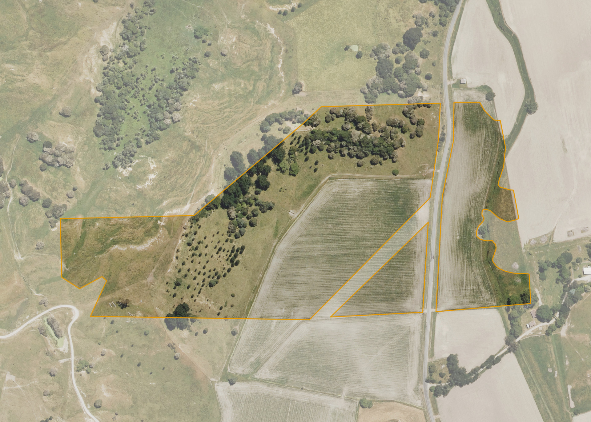
Okahuatiu 1A2 is a 16.7780 hectare property, split into two severances by Totangi Road, approximately 26 kilometres southeast of Gisborne. The eastern severance adjoins the Waikakariki Stream on the eastern boundary. The land is flat to easy/medium hill in contour.
The block is currently utilised for sheep and beef farming and arable cropping.
Land Information
- Land area:
- 16.778 hectares
- Location:
- Turnbull and Totangi Roads, Ngatapa
- Region:
- Gisborne
- Māori Land Court region:
- Tairawhiti
- Role of Māori Trustee for this whenua:
- Responsible Trustee
Learn more about the role of the Māori Trustee.
Owner Information
There are 1629 people or whānau trusts who have shares in Okahuatiu 1A2.
Find individual owners or whānau trusts for this whenua
Tip: Search by first name
If you have a question about this whenua or you want to update your details please contact us.
Find out about upcoming owner hui for this whenuaStay connected with My Whenua
My Whenua is our online service for owners, trustees, whānau and those with a connection to whenua we look after on their behalf.
It’s a way to stay up to date with information about your whenua, including:
- Maps and photos
- Owner reports
- A list of owners
- Minutes of owner hui, and more.