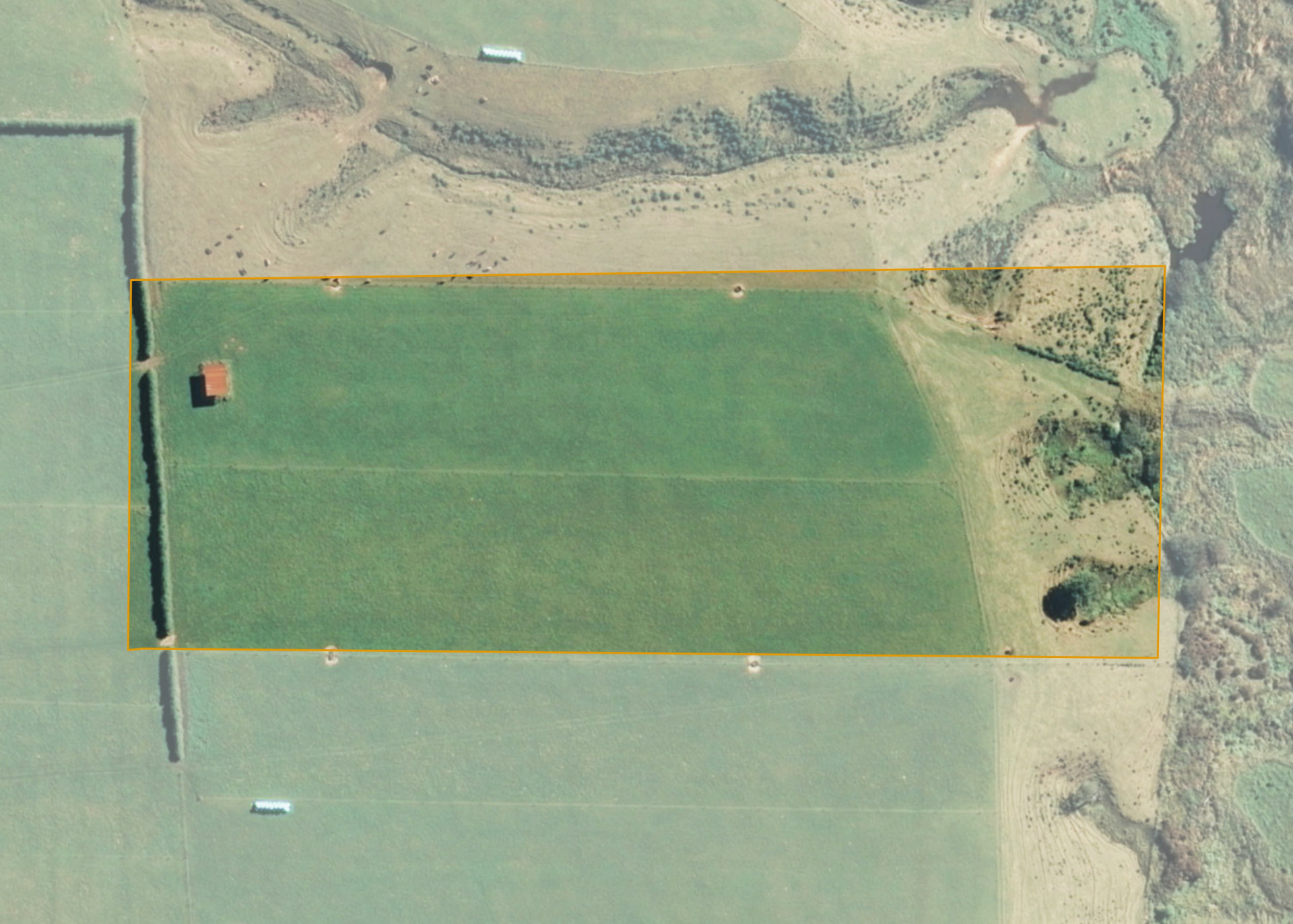
Ngatimanuhiakai 8B
Ngatimanuhiakai 8B is a 3.4398 hectare property situated on Upper Inaha Road, approximately 18 kilometres north-west of Hawera. The land is flat in contour running back to an area of hillside at the eastern end of the property. The flat area has an open aspect and the hillside has an eastern aspect. Soils on the property comprise of Egmont loam. The block can be accessed via adjoining land.
The block is entirely effective and is currently utilised for dairying in conjunction with adjoining leasehold lands.
There is a hay barn on the property.
Land Information
- Land area:
- 3.4398 hectares
- Location:
- Inaha Road, Hawera
- Region:
- Taranaki
- Māori Land Court region:
- Aotea
- Role of Māori Trustee for this whenua:
- Responsible Trustee
Learn more about the role of the Māori Trustee.
Owner Information
There are 38 people or whānau trusts who have shares in Ngatimanuhiakai 8B.
Find individual owners or whānau trusts for this whenua
Tip: Search by first name
If you have a question about this whenua or you want to update your details please contact us.
Find out about upcoming owner hui for this whenuaStay connected with My Whenua
My Whenua is our online service for owners, trustees, whānau and those with a connection to whenua we look after on their behalf.
It’s a way to stay up to date with information about your whenua, including:
- Maps and photos
- Owner reports
- A list of owners
- Minutes of owner hui, and more.