Whakapau 5G
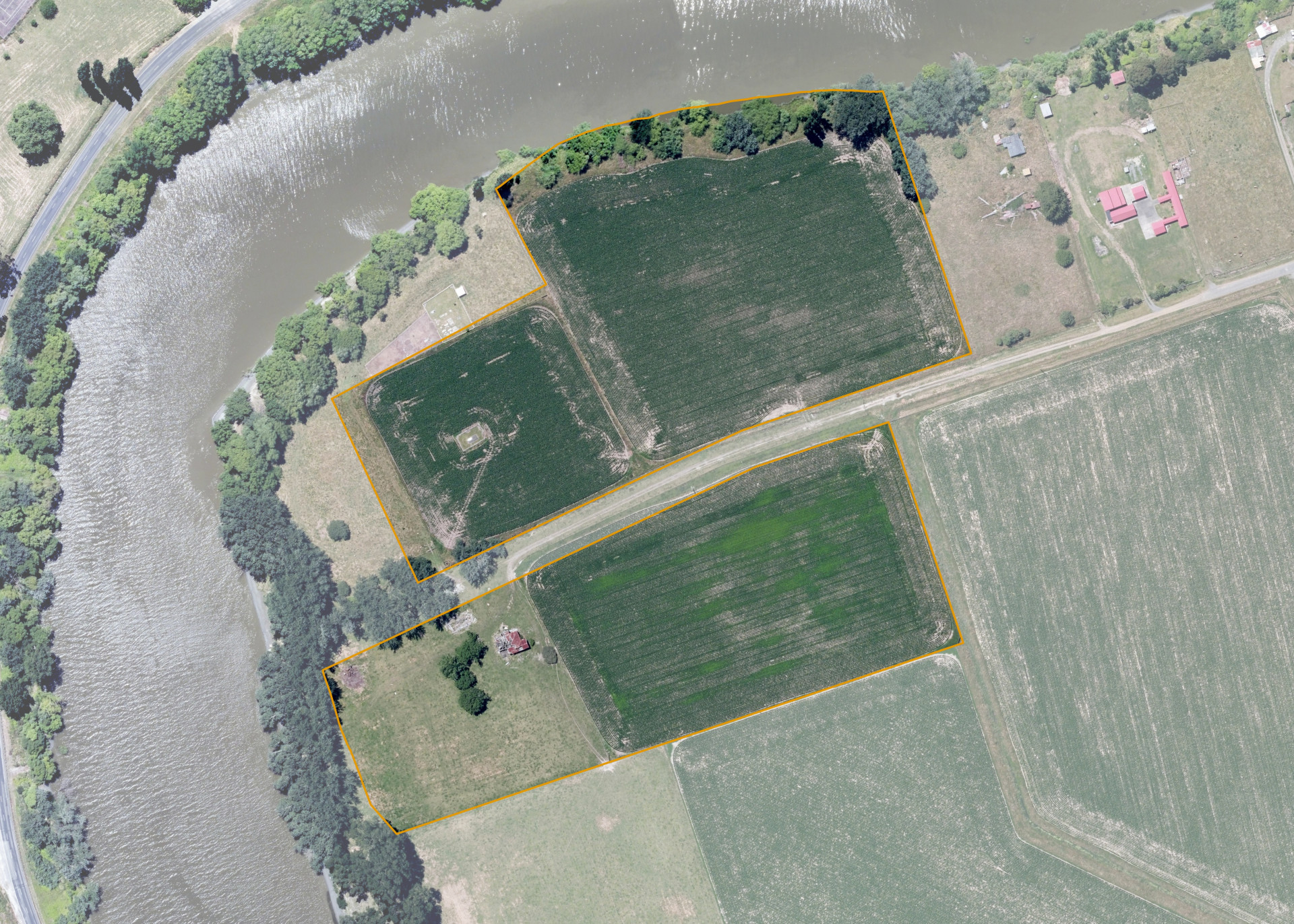
Whakapau 5G is an 8.3061 hectare property situated on Ruataniwha Road, approximately 4 kilometres from Wairoa. The land is flat to undulating in contour and bounds the Wairoa River on its northern and western boundaries. The property is dissected by Ruataniwha Road into two severances. The block can be accessed from Ruataniwha Road.
The block is currently utilised for maize cropping.
There is an urupa/monument located on the northern severance. And there is a derelict house on the southern severance of the block.
Land Information
- Land area:
- 8.3061 hectares
- Location:
- Ruataniwha Road, Wairoa
- Region:
- Hawkes Bay
- Māori Land Court region:
- Tairawhiti
- Role of Māori Trustee for this whenua:
- Responsible Trustee
Learn more about the role of the Māori Trustee.
Owner Information
There are 13 people or whānau trusts who have shares in Whakapau 5G.
Find individual owners or whānau trusts for this whenua
Tip: Search by first name
If you have a question about this whenua or you want to update your details please contact us.
Find out about upcoming owner hui for this whenuaStay connected with My Whenua
My Whenua is our online service for owners, trustees, whānau and those with a connection to whenua we look after on their behalf.
It’s a way to stay up to date with information about your whenua, including:
- Maps and photos
- Owner reports
- A list of owners
- Minutes of owner hui, and more.