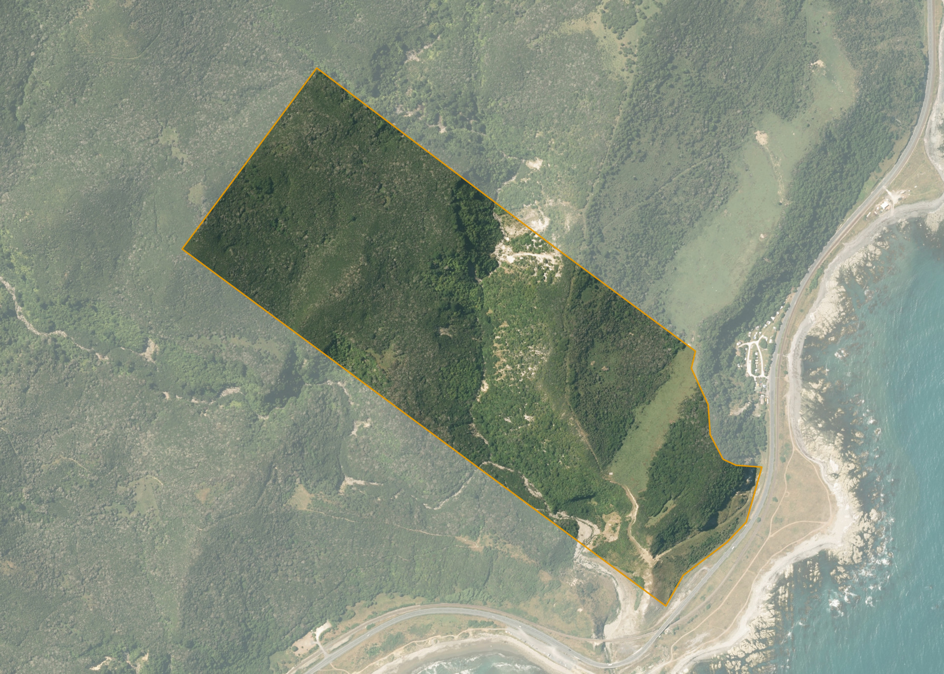
Mangamaunu No 2 Sub 1C
Mangamaunu 1C is a 61.1429 hectare property located on State Highway 1 near Clarence River.
The block is predominantly made up of deep gullies and high ridges and could provide limited rough grazing for a small number of sheep. Mangamaunu 1C is a very aesthetic block reverting to native bush and scrub with great sea views.
Land Information
- Land area:
- 61.1429 hectares
- Location:
- On State Highway 1, Clarence River
- Region:
- Canterbury
- Māori Land Court region:
- Te Waipounamu
- Role of Māori Trustee for this whenua:
- Responsible Trustee
Learn more about the role of the Māori Trustee.
Owner Information
There are 91 people or whānau trusts who have shares in Mangamaunu No 2 Sub 1C.
Find individual owners or whānau trusts for this whenua
Tip: Search by first name
If you have a question about this whenua or you want to update your details please contact us.
Find out about upcoming owner hui for this whenuaStay connected with My Whenua
My Whenua is our online service for owners, trustees, whānau and those with a connection to whenua we look after on their behalf.
It’s a way to stay up to date with information about your whenua, including:
- Maps and photos
- Owner reports
- A list of owners
- Minutes of owner hui, and more.