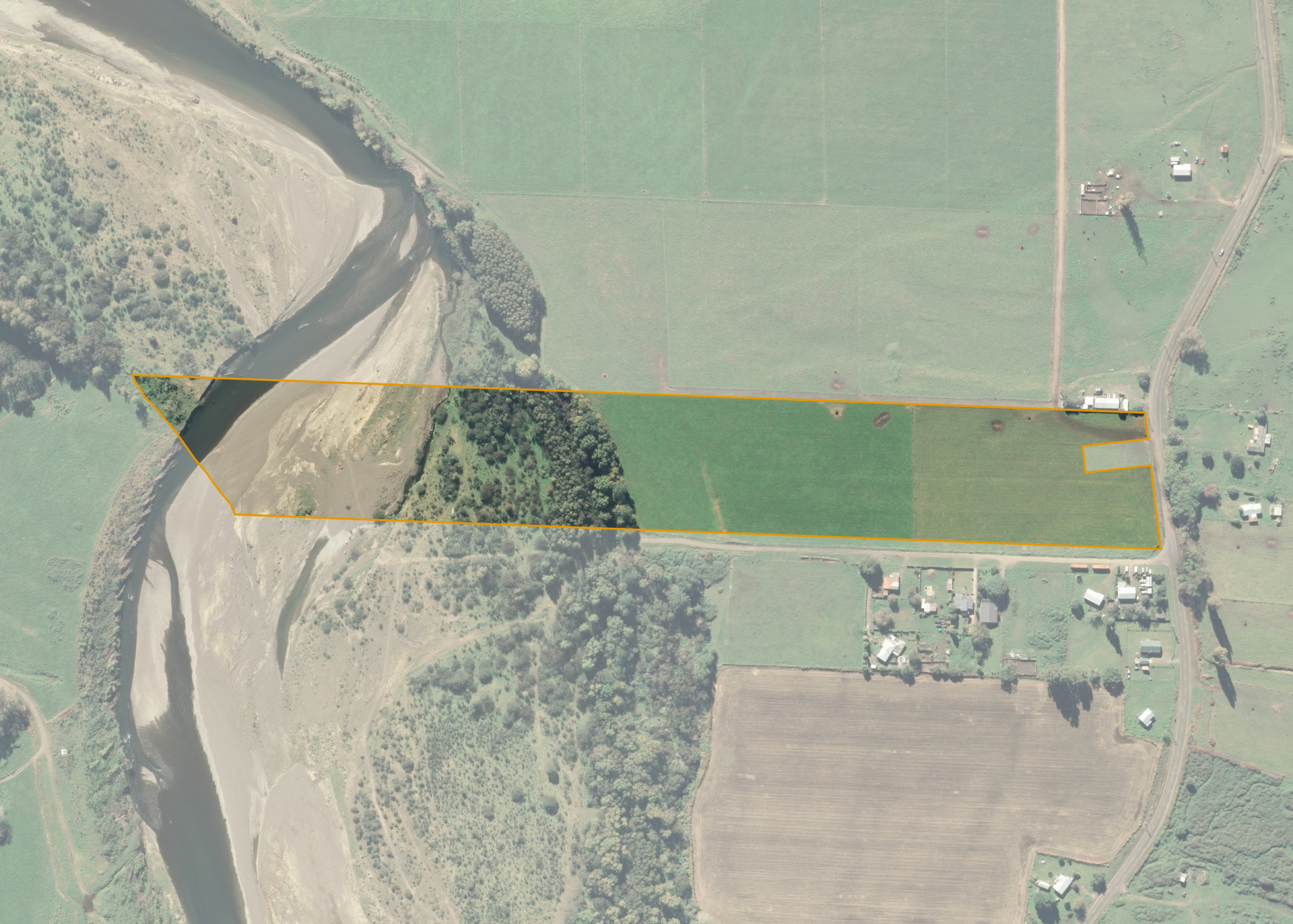
Ruatoki A60B
Ruatoki A60B is a 7.6 hectare property located on the north-western corner of Ruatoki Valley Road and Opurana Road, some 13.5 km from Taneatua.
This property is predominately flat and is rectangular in shape.
Ruatoki A60B is a part of a large dairy farm.
Land Information
- Land area:
- 7.6156 hectares
- Location:
- Ruatoki Valley Road, Ruatoki
- Region:
- Bay of Plenty
- Māori Land Court region:
- Waiariki
- Role of Māori Trustee for this whenua:
- Responsible Trustee
Learn more about the role of the Māori Trustee.
Owner Information
There are 12 people or whānau trusts who have shares in Ruatoki A60B.
Find individual owners or whānau trusts for this whenua
Tip: Search by first name
If you have a question about this whenua or you want to update your details please contact us.
Find out about upcoming owner hui for this whenuaStay connected with My Whenua
My Whenua is our online service for owners, trustees, whānau and those with a connection to whenua we look after on their behalf.
It’s a way to stay up to date with information about your whenua, including:
- Maps and photos
- Owner reports
- A list of owners
- Minutes of owner hui, and more.