Kawhia A2D1
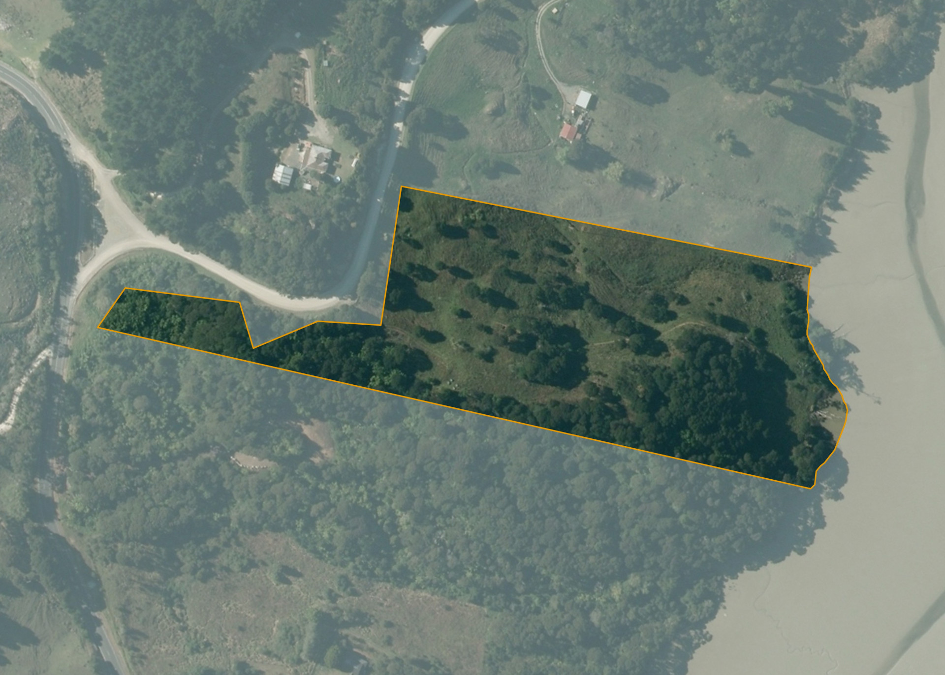
Kawhia A2D1 is a 3.0221 hectare property situated at the junction of Kawhia Road and Raglan Road, approximately 6 kilometres north-east of the Kawhia Township. The land is steep in contour and bounds the Mangaora River on its eastern boundary. The block can be accessed via a gate off Raglan road.
The property is currently vacant.
Land Information
- Land area:
- 3.0221 hectares
- Location:
- corner of Raglan, Kawhia and Otorohanga Road, Kawhia
- Region:
- Waikato
- Māori Land Court region:
- Waikato Maniapoto
- Role of Māori Trustee for this whenua:
- Responsible Trustee
Learn more about the role of the Māori Trustee.
Owner Information
There are 18 people or whānau trusts who have shares in Kawhia A2D1.
Find individual owners or whānau trusts for this whenua
Tip: Search by first name
If you have a question about this whenua or you want to update your details please contact us.
Find out about upcoming owner hui for this whenuaStay connected with My Whenua
My Whenua is our online service for owners, trustees, whānau and those with a connection to whenua we look after on their behalf.
It’s a way to stay up to date with information about your whenua, including:
- Maps and photos
- Owner reports
- A list of owners
- Minutes of owner hui, and more.