Kohatutaka 6A3B
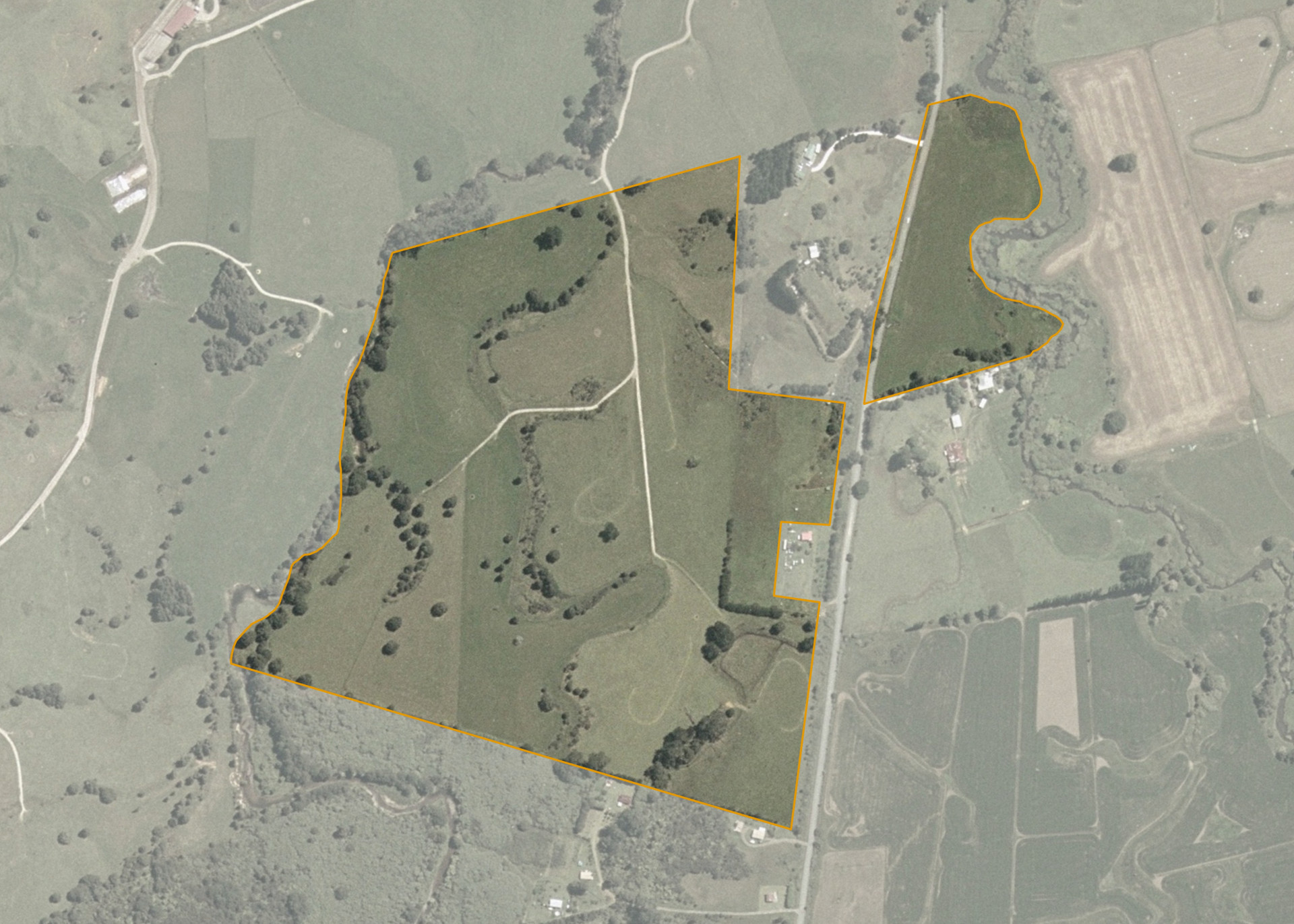
Kohatutaka 6A3B is a 33.1360 hectare property situated on Otaua Road, Punakitere, approximately 16 kilometres from Kaikohe. The land is mainly flat to easy hill in contour and has an open aspect.
The effective area, approximately 32 hectares, is currently utilised for dairying in conjunction with the adjoining farm. The balance of the land can be attributed to scrub, trees and the swampy area.
Land Information
- Land area:
- 33.136 hectares
- Location:
- Otaua Road, Otaua
- Region:
- Northland
- Māori Land Court region:
- Taitokerau
- Role of Māori Trustee for this whenua:
- Responsible Trustee
Learn more about the role of the Māori Trustee.
Owner Information
There are 56 people or whānau trusts who have shares in Kohatutaka 6A3B.
Find individual owners or whānau trusts for this whenua
Tip: Search by first name
If you have a question about this whenua or you want to update your details please contact us.
Find out about upcoming owner hui for this whenuaStay connected with My Whenua
My Whenua is our online service for owners, trustees, whānau and those with a connection to whenua we look after on their behalf.
It’s a way to stay up to date with information about your whenua, including:
- Maps and photos
- Owner reports
- A list of owners
- Minutes of owner hui, and more.