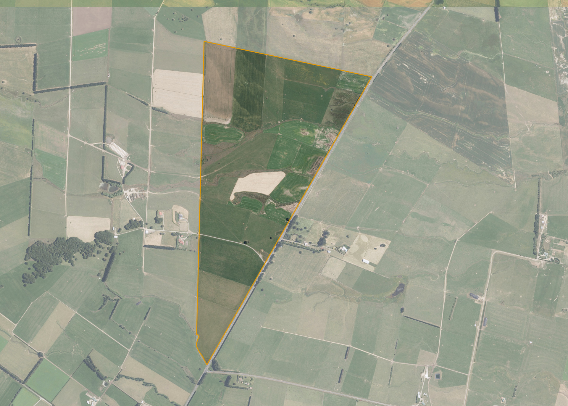
Rakautatahi A2
Rakautatahi A2 is a 94.3272 hectare property situated on State Highway 2, approximately 8 kilometres south of Norsewood. The land is predominantly flat in contour and is split by a sidling. The block can be accessed from State Highway 2.
The effective area of 89.65 hectares is currently utilised for dairy. The balance of the land can be attributed to riparian planting and fenced water courses.
There is a small pump shed and a set of cattle yards on the property.
Land Information
- Land area:
- 94.3272 hectares
- Location:
- State Highway 2, Norsewood
- Region:
- Hawkes Bay
- Māori Land Court region:
- Takitimu
- Role of Māori Trustee for this whenua:
- Responsible Trustee
Learn more about the role of the Māori Trustee.
Owner Information
There are 37 people or whānau trusts who have shares in Rakautatahi A2.
Find individual owners or whānau trusts for this whenua
Tip: Search by first name
If you have a question about this whenua or you want to update your details please contact us.
Find out about upcoming owner hui for this whenuaStay connected with My Whenua
My Whenua is our online service for owners, trustees, whānau and those with a connection to whenua we look after on their behalf.
It’s a way to stay up to date with information about your whenua, including:
- Maps and photos
- Owner reports
- A list of owners
- Minutes of owner hui, and more.