Otautu 15D
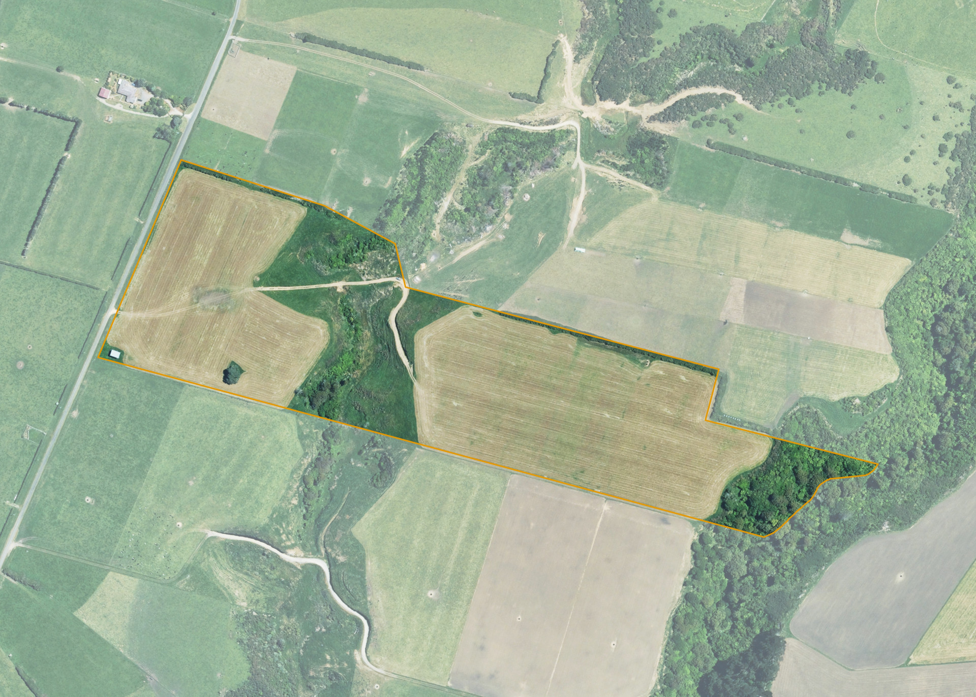
Otautu 15D is a 14.1639 hectare property of predominantly flat land. The block is situated on the eastern side of Otauto Road at Whenuakura, 10km's east of Patea. Access to the property is gained from Otauto Road.
The block is utilised as a diary runoff/support block for the lessees' dairy farm situated nearby on Kaharoa Road. The flat land area is also utilised to grow a maize silage crop over the spring, summer and early autumn period.
Otautu 15D comprises Egmont loam soils, a good free draining soil type. The effective area is some 11.76 hectares, with the ineffective area, some 2.4ha being attributed to the steep hill-face at the rear of the property in light bush and the swampy watercourse in the centre gully.
The flat land is dissected into two sections by a central gully running north to south. The back (eastern) flat runs into a steep gully on the eastern boundary of the property.
A bulldozed track and culvert crossing are provided to the central gully area.
The property is equipped with a 50 square metres 2 bay hayshed of older construction.
Land Information
- Land area:
- 14.164 hectares
- Location:
- Otauto Road, Whenuakura
- Region:
- Taranaki
- Māori Land Court region:
- Aotea
- Role of Māori Trustee for this whenua:
- Responsible Trustee
Learn more about the role of the Māori Trustee.
Owner Information
There are 23 people or whānau trusts who have shares in Otautu 15D.
Find individual owners or whānau trusts for this whenua
Tip: Search by first name
If you have a question about this whenua or you want to update your details please contact us.
Find out about upcoming owner hui for this whenuaStay connected with My Whenua
My Whenua is our online service for owners, trustees, whānau and those with a connection to whenua we look after on their behalf.
It’s a way to stay up to date with information about your whenua, including:
- Maps and photos
- Owner reports
- A list of owners
- Minutes of owner hui, and more.