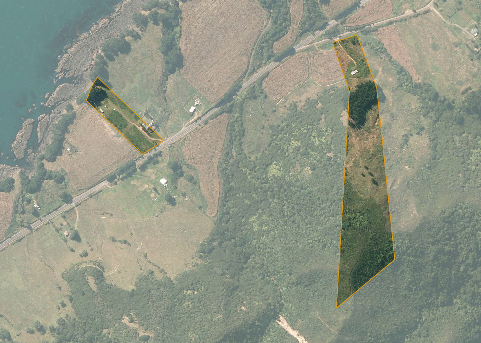
Hakota 5D2
Hakota 5D2 is a 6.7582 hectare property situated on both State Highway 35 and Waiorore Road, and is approximately 5 kilometres south-west of Te Kaha. The land ranges from near flat to steep hill in contour and presents as two severances. The block has frontage to both State Highway 35 and Waiorore Road.
The block is not currently leased. The land is predominantly covered in bush and scrub.
There is a dwelling on the property.
Land Information
- Land area:
- 6.7582 hectares
- Location:
- SH 35, TE KAHA
- Region:
- Bay of Plenty
- Māori Land Court region:
- Waiariki
- Role of Māori Trustee for this whenua:
- Responsible Trustee
Learn more about the role of the Māori Trustee.
Owner Information
There are 104 people or whānau trusts who have shares in Hakota 5D2.
Find individual owners or whānau trusts for this whenua
Tip: Search by first name
If you have a question about this whenua or you want to update your details please contact us.
Find out about upcoming owner hui for this whenuaStay connected with My Whenua
My Whenua is our online service for owners, trustees, whānau and those with a connection to whenua we look after on their behalf.
It’s a way to stay up to date with information about your whenua, including:
- Maps and photos
- Owner reports
- A list of owners
- Minutes of owner hui, and more.