Rangitikei Manawatu C7A
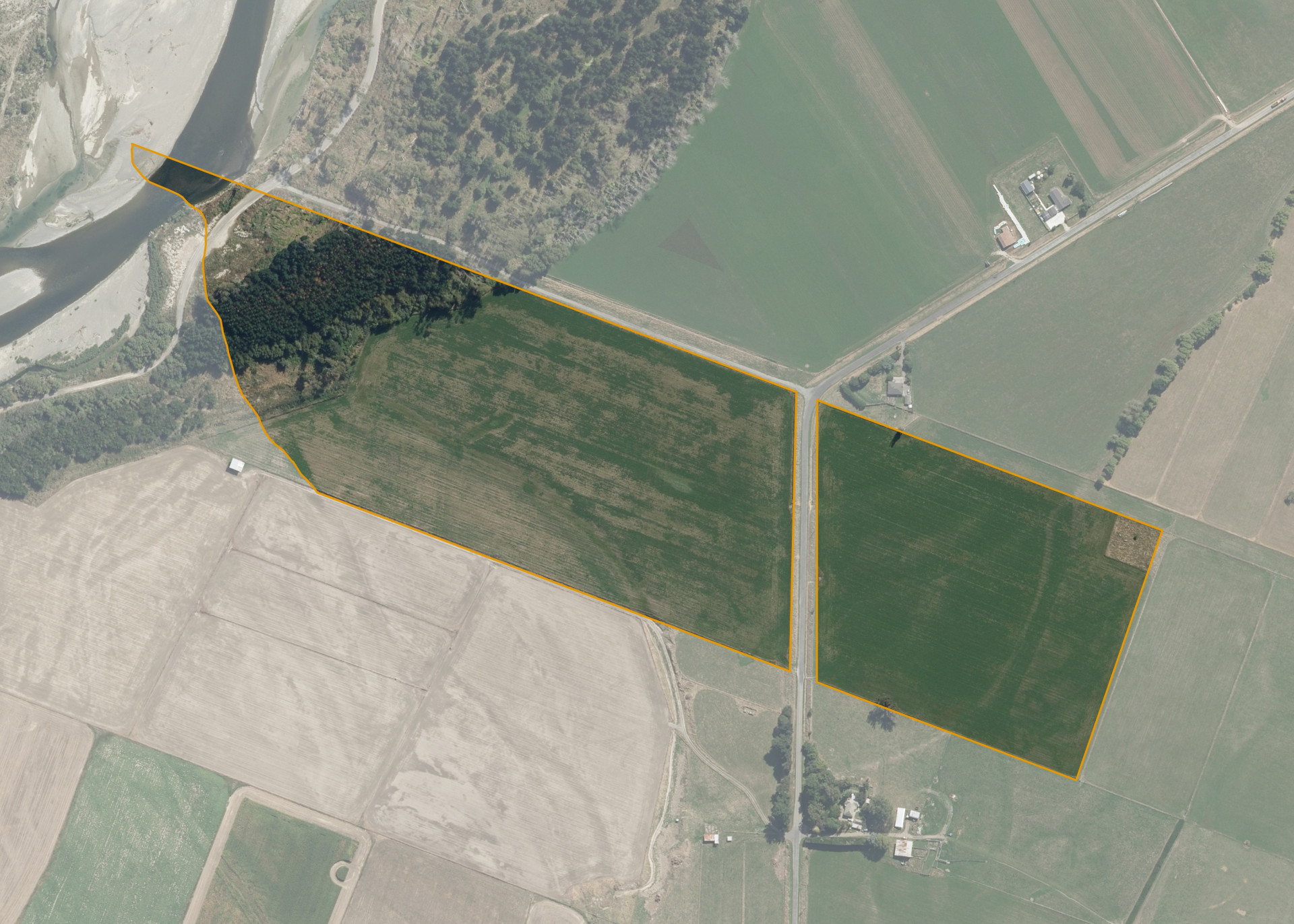
Rangitikei Manawatu C7A is a 20.3203 hectare property situated on either side of McDonell Road, approximately 5 kilometres west of Sanson. The land is flat to easy undulating in contour. Soils on the property comprise of Manawatu silt loam. The block can be accessed from the road.
The effective area, approximately 16.8100 hectares, is currently utilised for dairy grazing, feed and cash crops. The balance of the land can be attributed to pines and the unproductive river flats.
There is an urupa on the north eastern side of the property.
Land Information
- Land area:
- 20.3203 hectares
- Location:
- McDonnell Line, Bulls
- Region:
- Manawatu / Whanganui
- Māori Land Court region:
- Aotea
- Role of Māori Trustee for this whenua:
- Responsible Trustee
Learn more about the role of the Māori Trustee.
Owner Information
There are 120 people or whānau trusts who have shares in Rangitikei Manawatu C7A.
Find individual owners or whānau trusts for this whenua
Tip: Search by first name
If you have a question about this whenua or you want to update your details please contact us.
Find out about upcoming owner hui for this whenuaStay connected with My Whenua
My Whenua is our online service for owners, trustees, whānau and those with a connection to whenua we look after on their behalf.
It’s a way to stay up to date with information about your whenua, including:
- Maps and photos
- Owner reports
- A list of owners
- Minutes of owner hui, and more.