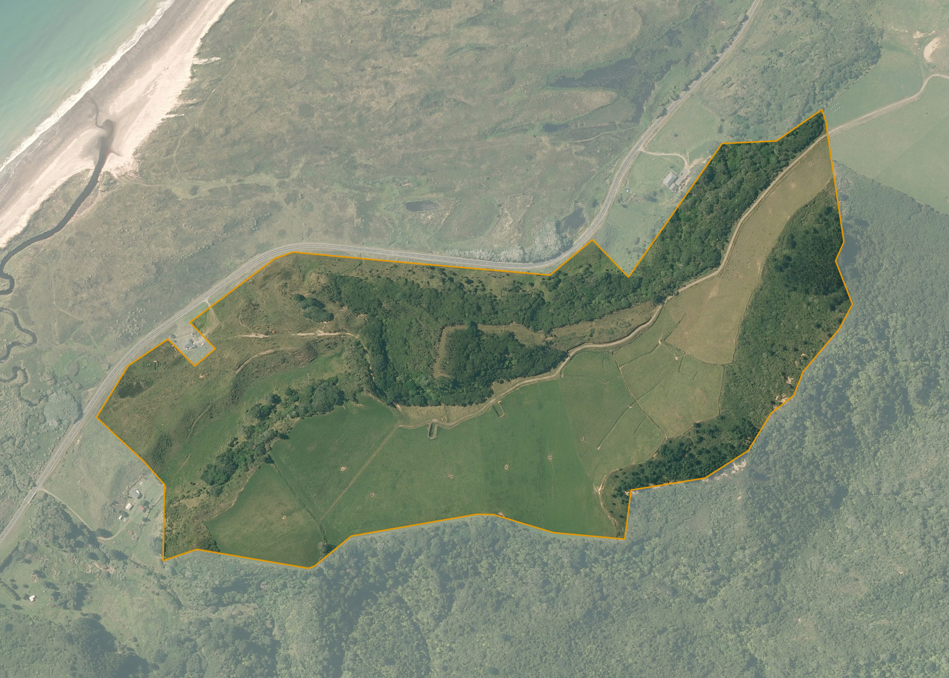
Whangaparaoa 1B2B7B
Whangaparaoa 1B2B7B is a 43.1710 hectare property situated on State Highway 35, approximately 9 kilometres southwest of Waihau Bay. The land is mixed in contour and has a predominantly northern aspect. Soils on the property comprise of Te Kaha and Wharekahika. The block can be accessed from the lessee's adjoining land.
The effective area, approximately 26.4 hectares, is currently utilised for dairy/dairy support. The balance of the land can be attributed to native bush.
Land Information
- Land area:
- 43.171 hectares
- Location:
- 11442 State Highway 35, Cape Runaway
- Region:
- Bay of Plenty
- Māori Land Court region:
- Waiariki
- Role of Māori Trustee for this whenua:
- Responsible Trustee
Learn more about the role of the Māori Trustee.
Owner Information
There are 12 people or whānau trusts who have shares in Whangaparaoa 1B2B7B.
Find individual owners or whānau trusts for this whenua
Tip: Search by first name
If you have a question about this whenua or you want to update your details please contact us.
Find out about upcoming owner hui for this whenuaStay connected with My Whenua
My Whenua is our online service for owners, trustees, whānau and those with a connection to whenua we look after on their behalf.
It’s a way to stay up to date with information about your whenua, including:
- Maps and photos
- Owner reports
- A list of owners
- Minutes of owner hui, and more.