Waihuka A2
Waihuka A2 is a 84.28 hectare block located in the Poroporo Valley. Access is via a right of way from Poroporo Valley Road.
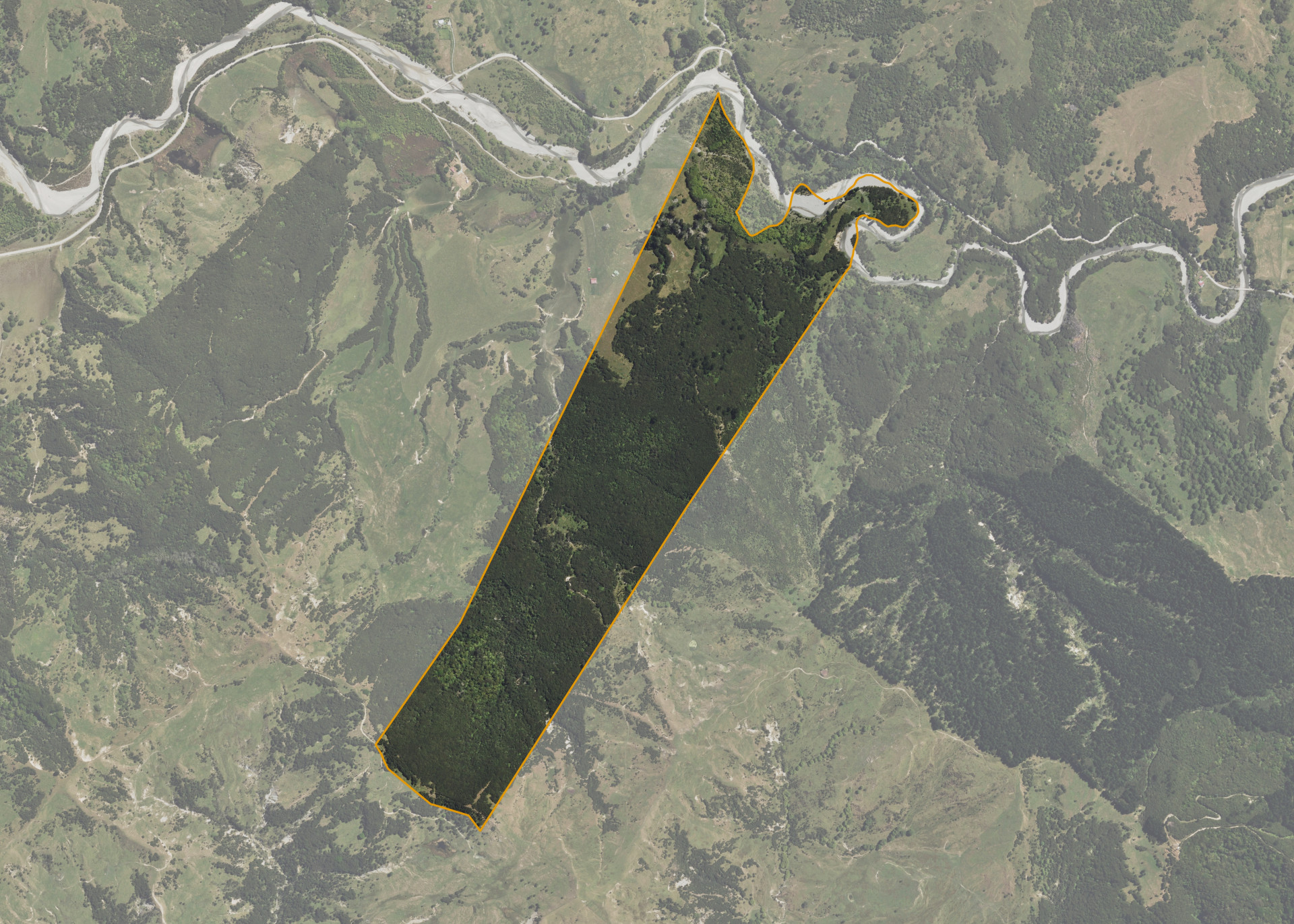
The block has an area of terrace flat which starts a narrow ridge. There are manuka clad hill slopes leading away from the ridge. Part of the block meets the Poroporo River, with the associated river flats encroaching onto the property.
Land Information
- Land area:
- 85.1458 hectares
- Location:
- Poroporo Valley, Tikitiki
- Region:
- Gisborne
- Māori Land Court region:
- Tairawhiti
- Role of Māori Trustee for this whenua:
- Other
Learn more about the role of the Māori Trustee.
Owner Information
There are 343 people or whānau trusts who have shares in Waihuka A2.
Find individual owners or whānau trusts for this whenua
Tip: Search by first name
If you have a question about this whenua or you want to update your details please contact us.
Find out about upcoming owner hui for this whenuaStay connected with My Whenua
My Whenua is our online service for owners, trustees, whānau and those with a connection to whenua we look after on their behalf.
It’s a way to stay up to date with information about your whenua, including:
- Maps and photos
- Owner reports
- A list of owners
- Minutes of owner hui, and more.