Kauangaroa 3E1 & 3G1A2
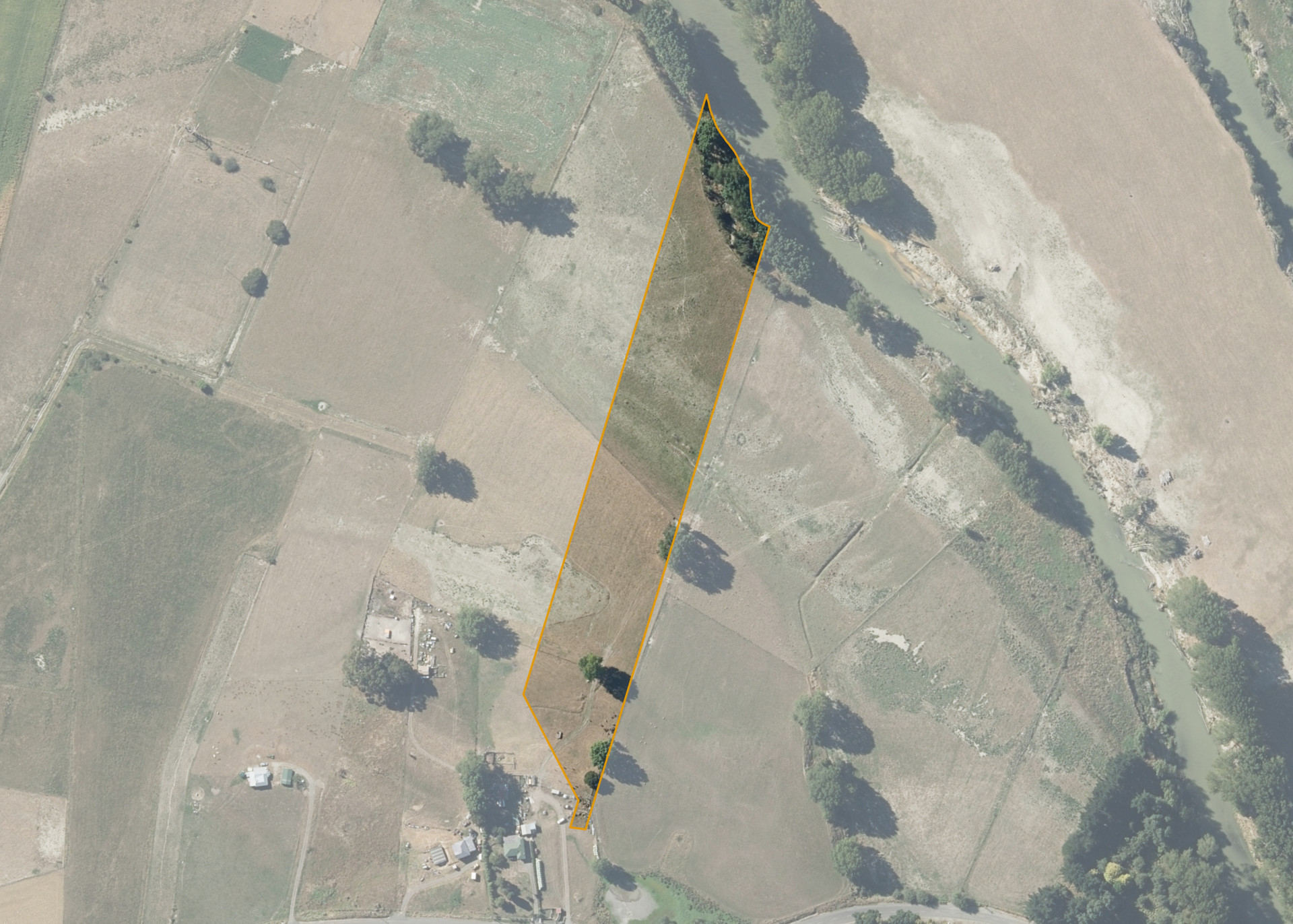
Kauangaroa 3E1 & 3G1A2 is a 2.7316 hectare property situated on Kauangaroa Road, approximately 20 kilometres from Whanganui. The land is flat in contour and has a northerly aspect. The Whangaehu River is located on the northern boundary.
The block can be accessed from the south via an easement over Kauangaroa 3E No.1 and 3G No.1A Sub.4 to Kauangaroa Road.
The effective area, approximately 2.5 hectares, is currently utilised for maize cropping and beef finishing.
There is an old and damaged hayshed on the property.
Land Information
- Land area:
- 2.7316 hectares
- Location:
- Kauangaroa Road, Fordell
- Region:
- Manawatu / Whanganui
- Māori Land Court region:
- Aotea
- Role of Māori Trustee for this whenua:
- Responsible Trustee
Learn more about the role of the Māori Trustee.
Owner Information
There are 50 people or whānau trusts who have shares in Kauangaroa 3E1 & 3G1A2.
Find individual owners or whānau trusts for this whenua
Tip: Search by first name
If you have a question about this whenua or you want to update your details please contact us.
Find out about upcoming owner hui for this whenuaStay connected with My Whenua
My Whenua is our online service for owners, trustees, whānau and those with a connection to whenua we look after on their behalf.
It’s a way to stay up to date with information about your whenua, including:
- Maps and photos
- Owner reports
- A list of owners
- Minutes of owner hui, and more.