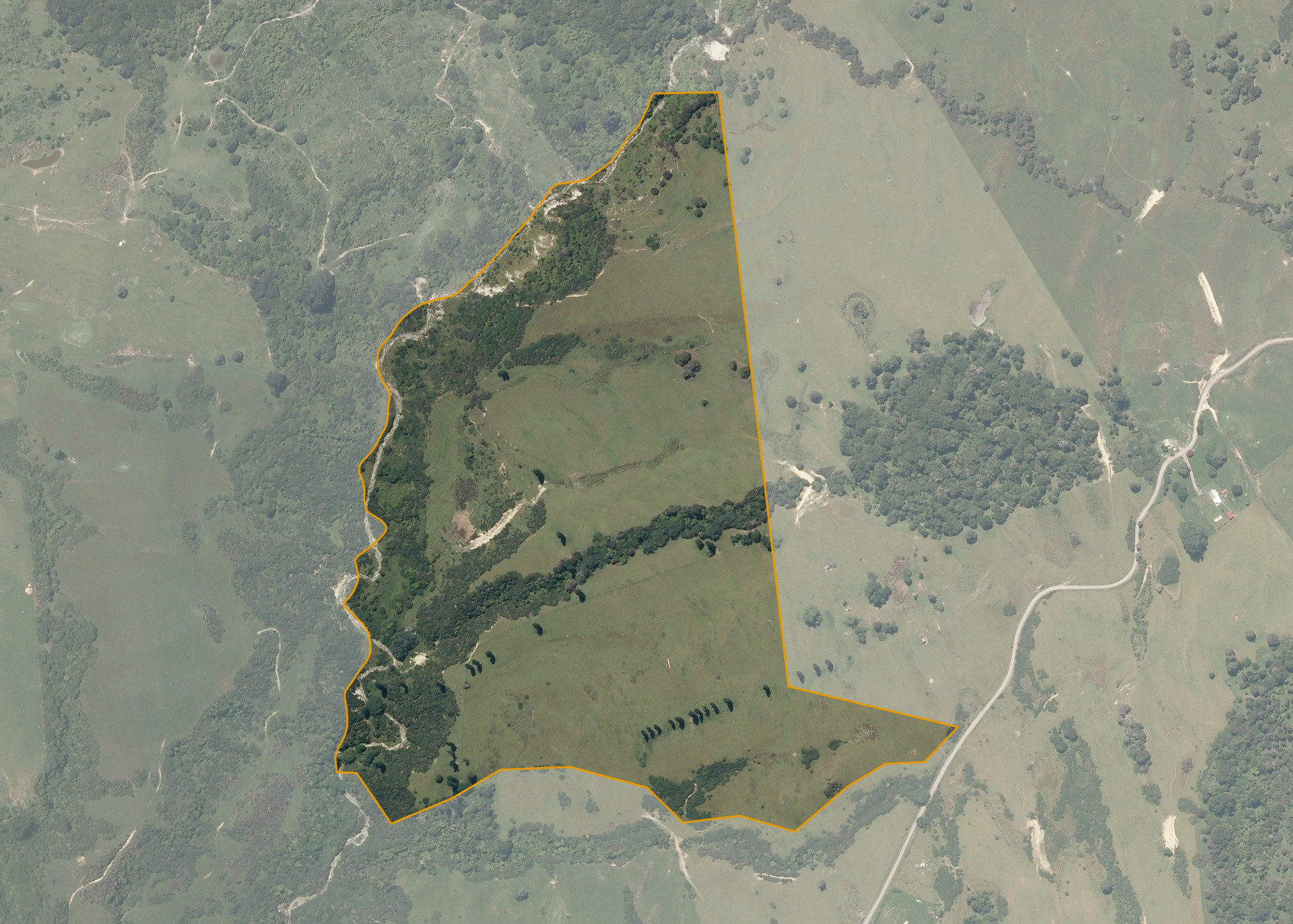
Ngarakauwhakarara 10A
Ngarakauwhakarara 10A is a 32.7795 hectare property situated on Mokonui Road, approximately 50 kilometres north of Whanganui. The land is undulating in contour to the east, with some steeper clean sidlings having a predominantly south west facing aspect. Soils on the property comprise of volcanic loam. The block can be accessed from Mokonui Road.
The effective area, approximately 20.8 hectares, is currently utilised for beef breeding and finishing. The balance of the land can be attributed to steep sidlings, the Whataumu Stream and bush.
Land Information
- Land area:
- 32.7795 hectares
- Location:
- 168 Mokonui Road, Whanganui
- Region:
- Manawatu / Whanganui
- Māori Land Court region:
- Aotea
- Role of Māori Trustee for this whenua:
- Responsible Trustee
Learn more about the role of the Māori Trustee.
Owner Information
There are 20 people or whānau trusts who have shares in Ngarakauwhakarara 10A.
Find individual owners or whānau trusts for this whenua
Tip: Search by first name
If you have a question about this whenua or you want to update your details please contact us.
Find out about upcoming owner hui for this whenuaStay connected with My Whenua
My Whenua is our online service for owners, trustees, whānau and those with a connection to whenua we look after on their behalf.
It’s a way to stay up to date with information about your whenua, including:
- Maps and photos
- Owner reports
- A list of owners
- Minutes of owner hui, and more.