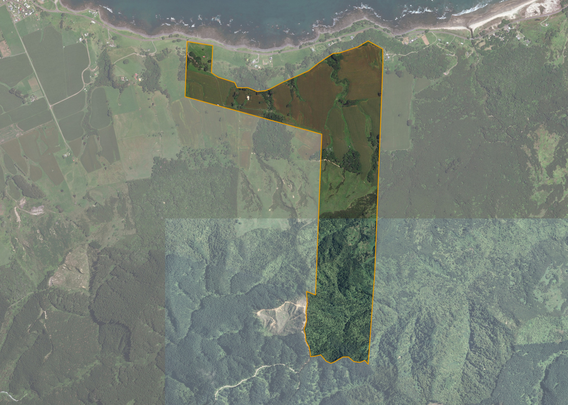
Matapapa 2B
Matapapa 2B is a 130.622 hectare property situated on State Highway 35, approximately 1.5 kilometres from Waihau Bay. The land ranges from flat to steep hill in contour. The block can be accessed from State Highway 35.
The property is currently leased to two separate tenants.
The flat to easy land, approximately 46 hectares, is currently utilised for maize cropping.
The medium to steep hill land, approximately 13.3 hectares, is currently utilised for dry-stock grazing in conjunction with adjoining land.
The balance of the property can be attributed to scrub and steep bush.
There is an old farmhouse, a hay barn, a woolshed with sheep yards and a set of cattle yards on the property.
Land Information
- Land area:
- 130.622 hectares
- Location:
- State Highway 35, Waihau Bay
- Region:
- Bay of Plenty
- Māori Land Court region:
- Waiariki
- Role of Māori Trustee for this whenua:
- Other
Learn more about the role of the Māori Trustee.
Owner Information
There are 136 people or whānau trusts who have shares in Matapapa 2B.
Find individual owners or whānau trusts for this whenua
Tip: Search by first name
If you have a question about this whenua or you want to update your details please contact us.
Find out about upcoming owner hui for this whenuaStay connected with My Whenua
My Whenua is our online service for owners, trustees, whānau and those with a connection to whenua we look after on their behalf.
It’s a way to stay up to date with information about your whenua, including:
- Maps and photos
- Owner reports
- A list of owners
- Minutes of owner hui, and more.