Tatua East 4C3B2
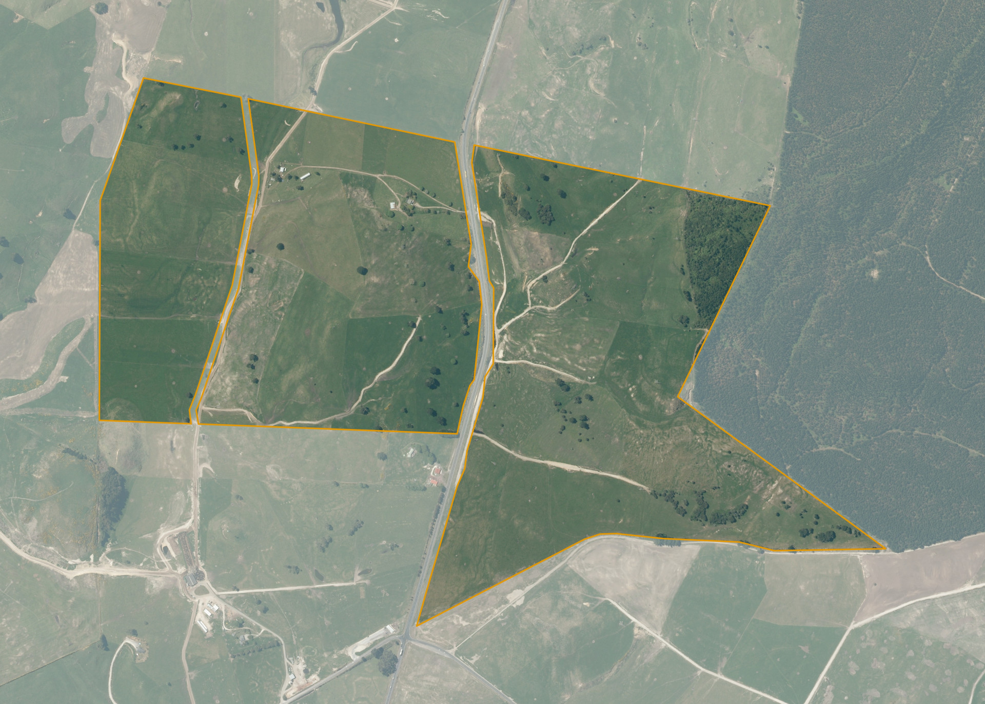
Tatua East 4C3B2 is a 169.1790 hectare property situated on State Highway 1, Maroa, and is approximately 23 kilometres from Taupo. The land ranges from flat to rolling in contour and is bisected by State Highway 1. The block can be accessed via State Highway 1 and adjoining land.
The effective area, approximately 163.3 hectares, is currently utilised for dairy farming in conjunction with adjoining land. The balance of the land can be attributed to bush and the area to the north of the western block including the buildings.
There is an old dwelling, barn and woolshed on the property that were previously excluded, however are now included in the lease.
Land Information
- Land area:
- 169.179 hectares
- Location:
- SH 1, Maroa
- Region:
- Bay of Plenty
- Māori Land Court region:
- Waiariki
- Role of Māori Trustee for this whenua:
- Responsible Trustee
Learn more about the role of the Māori Trustee.
Owner Information
There are 253 people or whānau trusts who have shares in Tatua East 4C3B2.
Find individual owners or whānau trusts for this whenua
Tip: Search by first name
If you have a question about this whenua or you want to update your details please contact us.
Find out about upcoming owner hui for this whenuaStay connected with My Whenua
My Whenua is our online service for owners, trustees, whānau and those with a connection to whenua we look after on their behalf.
It’s a way to stay up to date with information about your whenua, including:
- Maps and photos
- Owner reports
- A list of owners
- Minutes of owner hui, and more.