Wharepuhunga 7C3A2A
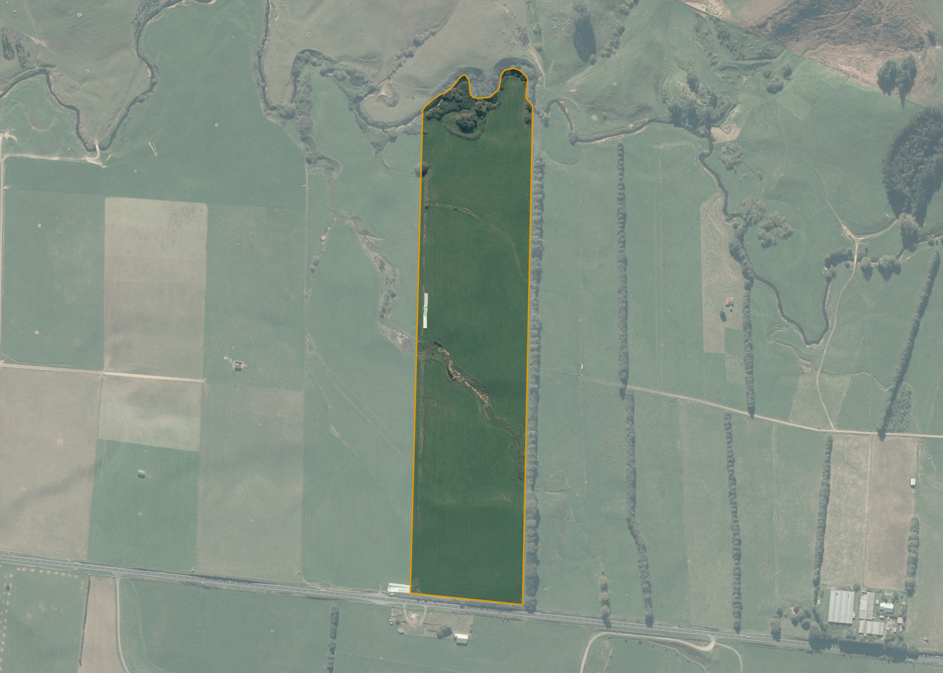
Wharepuhunga 7C3A2A is a 13.1978 hectare property situated on the northern side of Owairaka Valley Road, approximately 20 kilometres from Te Awamutu. The land is easy undulating in contour with a natural waterway crossing through the property from east to west. The block has frontage to Owairaka Road. The block is currently accessed through adjoining land.
The effective area, approximately 12.0 hectares, is currently utilised for dairy support wintering dairy cows and making hay or silage supplement feed over the summer. The balance of the land can be attributed to streams and drains.
Land Information
- Land area:
- 13.1978 hectares
- Location:
- Owairaka Valley Road, Te Awamutu
- Region:
- Waikato
- Māori Land Court region:
- Waikato Maniapoto
- Role of Māori Trustee for this whenua:
- Responsible Trustee
Learn more about the role of the Māori Trustee.
Owner Information
There are 35 people or whānau trusts who have shares in Wharepuhunga 7C3A2A.
Find individual owners or whānau trusts for this whenua
Tip: Search by first name
If you have a question about this whenua or you want to update your details please contact us.
Find out about upcoming owner hui for this whenuaStay connected with My Whenua
My Whenua is our online service for owners, trustees, whānau and those with a connection to whenua we look after on their behalf.
It’s a way to stay up to date with information about your whenua, including:
- Maps and photos
- Owner reports
- A list of owners
- Minutes of owner hui, and more.