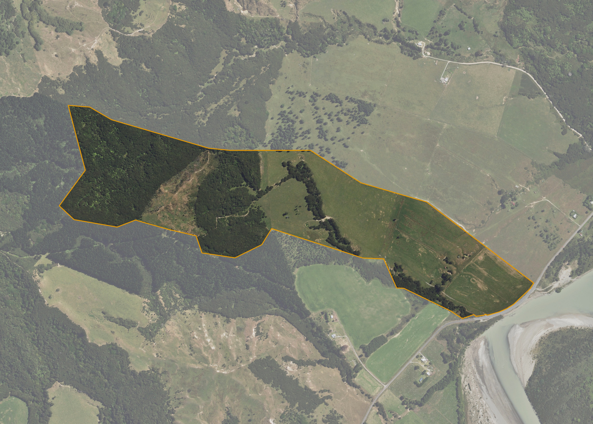
Turitaka A2
Turitaka A2 is a 77.9705 hectare property situated on Te Araroa Road, State Highway 35, and is approximately 3 kilometres from the Tikitiki township. The land is flat to steep hill in contour. The block can be accessed from Te Araroa Road.
The effective area, approximately 35 hectares, is currently utilised for grazing. The balance of the land can be attributed to reverting hill and dense scrub.
There is an old shed on the property.
There is an urupa on the property that has been fenced off.
Land Information
- Land area:
- 77.9705 hectares
- Location:
- Te Araroa Rd/SH35, Tikitiki
- Region:
- Gisborne
- Māori Land Court region:
- Tairawhiti
- Role of Māori Trustee for this whenua:
- Responsible Trustee
Learn more about the role of the Māori Trustee.
Owner Information
There are 51 people or whānau trusts who have shares in Turitaka A2.
Find individual owners or whānau trusts for this whenua
Tip: Search by first name
If you have a question about this whenua or you want to update your details please contact us.
Find out about upcoming owner hui for this whenuaStay connected with My Whenua
My Whenua is our online service for owners, trustees, whānau and those with a connection to whenua we look after on their behalf.
It’s a way to stay up to date with information about your whenua, including:
- Maps and photos
- Owner reports
- A list of owners
- Minutes of owner hui, and more.