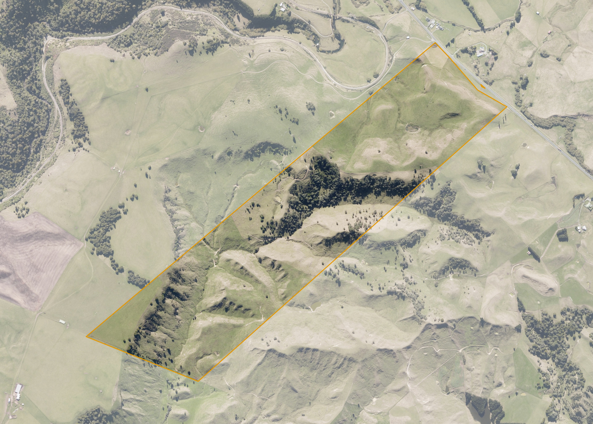
Motukawa 2B 9A
Motukawa 2B 9A is an 88.31 hectare property situated at Turangarere on the southern side of State Highway 1, approximately 13 kilometres south of Taihape. The land is a mixture of easy rolling to steep hill in contour with a small area of flat in the south western corner. The block can be accessed from the main road and a track is provided through the middle and back areas of the property.
The effective area, approximately 85.0 hectares, is currently utilised for grazing in conjunction with adjoining land as a part of a larger sheep and cattle enterprise. The balance of the land can be attributed to scattered trees and bush reversion.
There is a set of cattle yards on the property.
Land Information
- Land area:
- 88.3099 hectares
- Location:
- State Highway 1, Ruanui
- Region:
- Manawatu / Whanganui
- Māori Land Court region:
- Aotea
- Role of Māori Trustee for this whenua:
- Responsible Trustee
Learn more about the role of the Māori Trustee.
Owner Information
There are 61 people or whānau trusts who have shares in Motukawa 2B 9A.
Find individual owners or whānau trusts for this whenua
Tip: Search by first name
If you have a question about this whenua or you want to update your details please contact us.
Find out about upcoming owner hui for this whenuaStay connected with My Whenua
My Whenua is our online service for owners, trustees, whānau and those with a connection to whenua we look after on their behalf.
It’s a way to stay up to date with information about your whenua, including:
- Maps and photos
- Owner reports
- A list of owners
- Minutes of owner hui, and more.