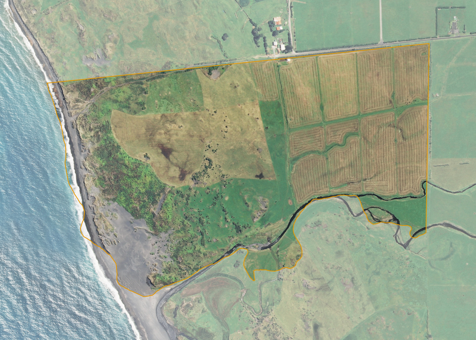
Pukerimu (Sec 102 Blk 1 Opunake SD)
Pukerimu (Sec 102 Blk 1 Opunake SD) is a 53.4184 hectare property situated on Lower Kahui Road, approximately 2.7 kilometres from Rahotu in coastal Taranaki. The land is flat in contour on the eastern portion running to rolling coastal sand dunes at the rear or western end which adjoins the Tasman Sea. Soils on the property comprise of Egmont loam in the east and Patea sandy loam to the west. The block can be accessed from Lower Kahui Road.
The effective area, approximately 40 hectares, is currently utilised for dairy run-off as a support block for the lessee's neighbouring dairy farm. The balance of the land is made up of retired sensitive sand dune areas. There is a pump shed on the banks of the Pungaereere Stream and cattle yards and a loading ramp adjacent to the entrance of the property.
Land Information
- Land area:
- 53.4184 hectares
- Location:
- Lower Kahui Road, Rahotu
- Region:
- Taranaki
- Māori Land Court region:
- Aotea
- Role of Māori Trustee for this whenua:
- Responsible Trustee
Learn more about the role of the Māori Trustee.
Owner Information
There are 274 people or whānau trusts who have shares in Pukerimu (Sec 102 Blk 1 Opunake SD).
Find individual owners or whānau trusts for this whenua
Tip: Search by first name
If you have a question about this whenua or you want to update your details please contact us.
Find out about upcoming owner hui for this whenuaStay connected with My Whenua
My Whenua is our online service for owners, trustees, whānau and those with a connection to whenua we look after on their behalf.
It’s a way to stay up to date with information about your whenua, including:
- Maps and photos
- Owner reports
- A list of owners
- Minutes of owner hui, and more.