Te Ahoroa A9
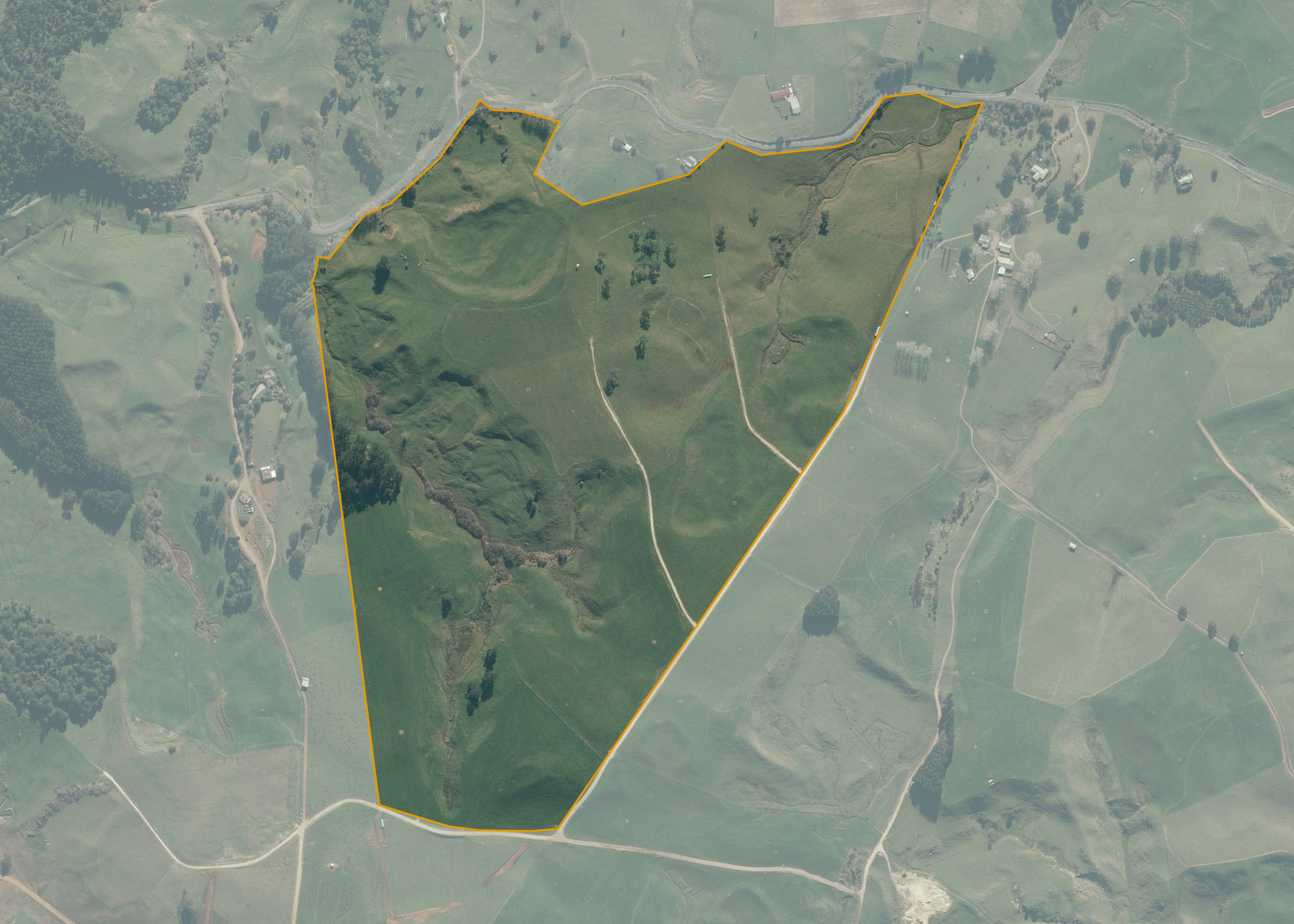
Te Ahoroa A9 is a 72.0642 hectare property situated on Rangitoto Road, approximately 8.8 kilometres west of Te Kuiti. The land is predominantly undulating to medium hill country in contour and is broken in part by shallow gullies and natural water courses. The block can be accessed from Rangitoto Road but is mostly accessed via the lessee's adjoining properties.
The effective area, approximately 66.734 hectares, is currently utilised for dairy platform. The balance of the land can be attributed to bush, waterways and swampy areas.
Land Information
- Land area:
- 72.0642 hectares
- Location:
- Ahoroa Road, Te Kuiti
- Region:
- Waikato
- Māori Land Court region:
- Waikato Maniapoto
- Role of Māori Trustee for this whenua:
- Responsible Trustee
Learn more about the role of the Māori Trustee.
Owner Information
There are 63 people or whānau trusts who have shares in Te Ahoroa A9.
Find individual owners or whānau trusts for this whenua
Tip: Search by first name
If you have a question about this whenua or you want to update your details please contact us.
Find out about upcoming owner hui for this whenuaStay connected with My Whenua
My Whenua is our online service for owners, trustees, whānau and those with a connection to whenua we look after on their behalf.
It’s a way to stay up to date with information about your whenua, including:
- Maps and photos
- Owner reports
- A list of owners
- Minutes of owner hui, and more.