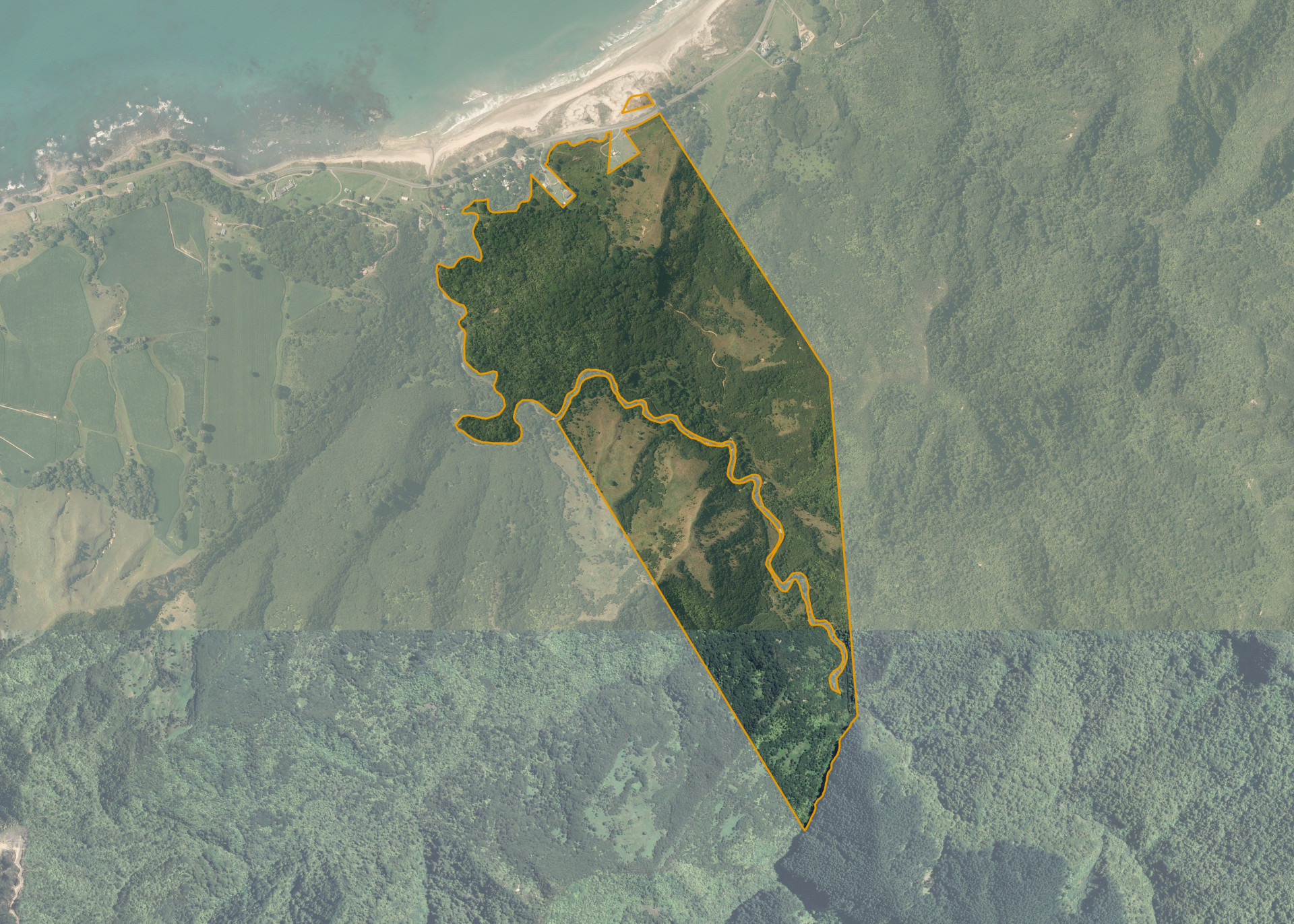
Matapapa 3
Matapapa 3 is 123.3948 hectares and is situated on SH35, at Waihau Bay, approximately 106 km by sealed road north-east of Opotiki, and 150 km north-east of Whakatane in the Eastern Bay of Plenty. The front of the land is along SH35.
Matapapa 3 comprises a block of hill country cut into two by the Mangatoetoe stream. The land can be farmed as part of a larger sheep and cattle operation.
The best use of the property would be for recreational purposes with the large bush area at the front of the block being ring fenced and allowed to regenarate. There is a good sandy beach on the opposite side of SH35. The block has potential for hunting, horse trekking or for the use as a base for fishing.
Land Information
- Land area:
- 123.3948 hectares
- Location:
- State Highway 35, Waihau Bay
- Region:
- Bay of Plenty
- Māori Land Court region:
- Waiariki
- Role of Māori Trustee for this whenua:
- Other
Learn more about the role of the Māori Trustee.
Owner Information
There are 136 people or whānau trusts who have shares in Matapapa 3.
Find individual owners or whānau trusts for this whenua
Tip: Search by first name
If you have a question about this whenua or you want to update your details please contact us.
Find out about upcoming owner hui for this whenuaStay connected with My Whenua
My Whenua is our online service for owners, trustees, whānau and those with a connection to whenua we look after on their behalf.
It’s a way to stay up to date with information about your whenua, including:
- Maps and photos
- Owner reports
- A list of owners
- Minutes of owner hui, and more.