Karaka B1B
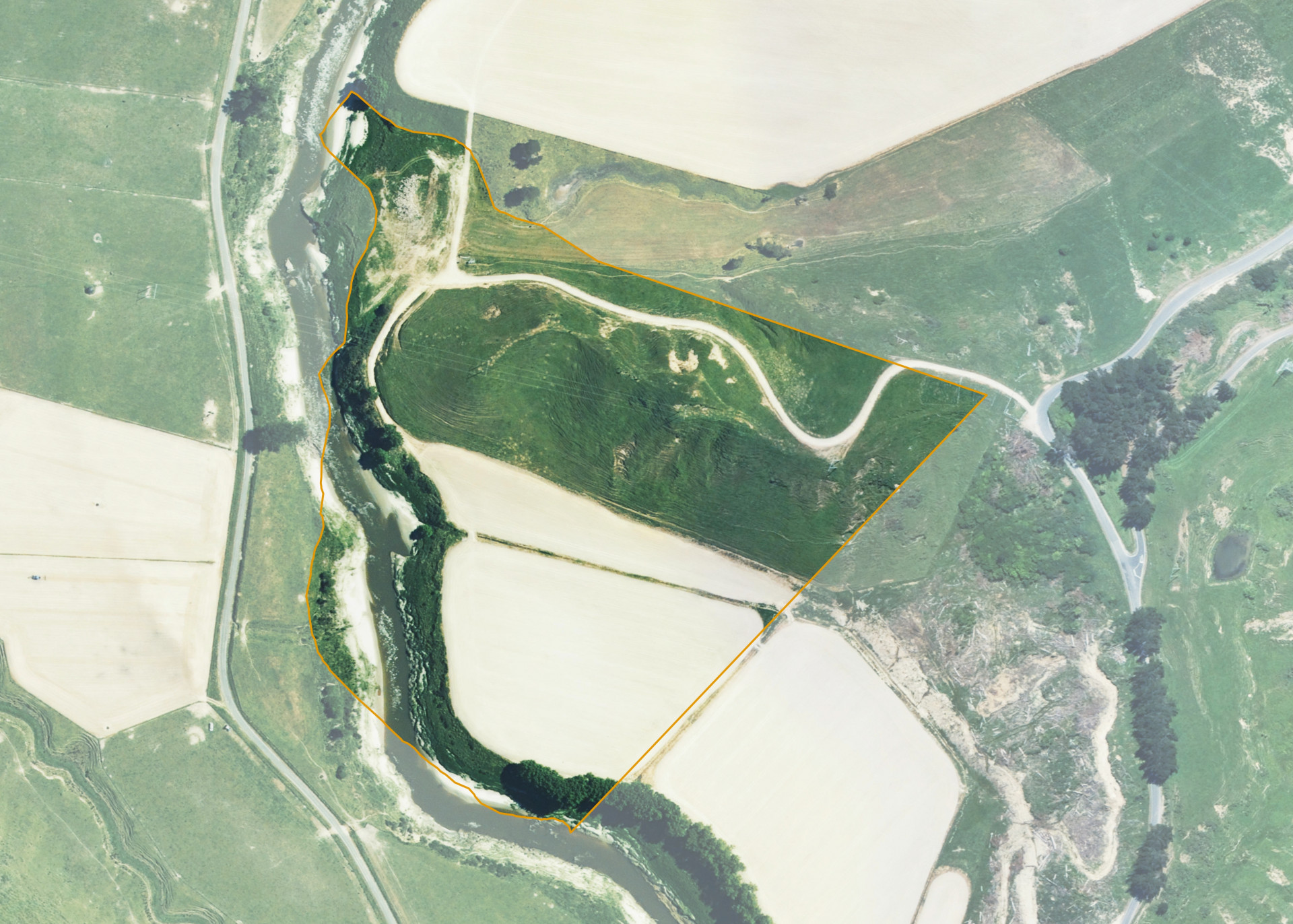
Karaka B1B is an 11.6094 hectare property situated on Waitotara Valley Road, approximately 36 kilometres north-west of Whanganui. The land is Medium steep hillside running to river flat bordering the Waitotara River in contour. Soils on the property comprise of grey silt loam on clay loam mottled grey and brown. The block can be accessed from Waitotara Valley Road.
The effective area, approximately 11.10 hectares, is currently utilised for maize cropping and annual ryegrass rotation. The balance of the land can be attributed to willows, reversion and the river bank.
Land Information
- Land area:
- 11.6094 hectares
- Location:
- Waitotara Valley Road, Waitotara
- Region:
- Taranaki
- Māori Land Court region:
- Aotea
- Role of Māori Trustee for this whenua:
- Responsible Trustee
Learn more about the role of the Māori Trustee.
Owner Information
There are 76 people or whānau trusts who have shares in Karaka B1B.
Find individual owners or whānau trusts for this whenua
Tip: Search by first name
If you have a question about this whenua or you want to update your details please contact us.
Find out about upcoming owner hui for this whenuaStay connected with My Whenua
My Whenua is our online service for owners, trustees, whānau and those with a connection to whenua we look after on their behalf.
It’s a way to stay up to date with information about your whenua, including:
- Maps and photos
- Owner reports
- A list of owners
- Minutes of owner hui, and more.