Ngatimanuhiakai 21B 2B
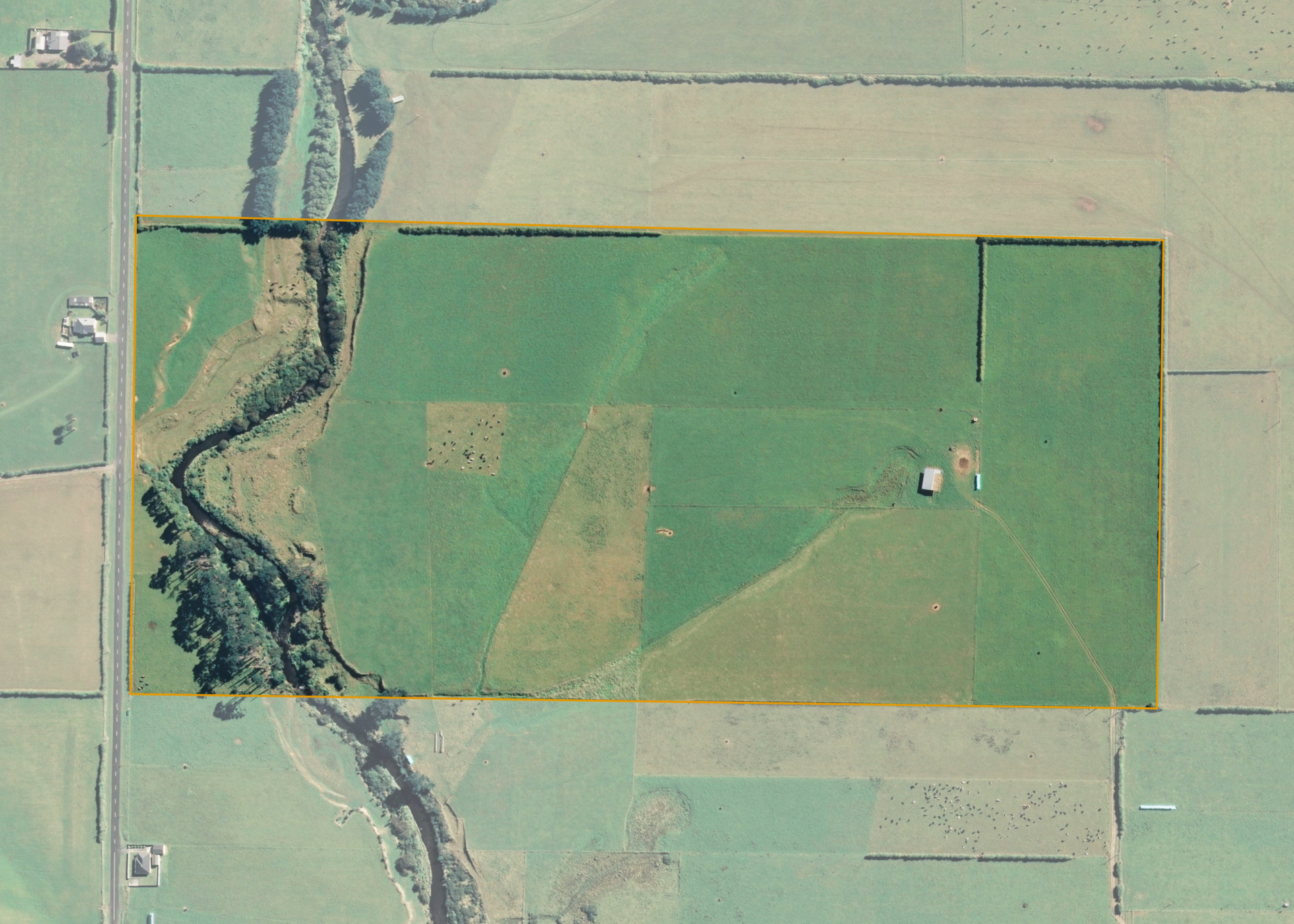
Ngatimanuhiakai 21B 2B is a 26.0112 hectare property situated on Kokiri Road, approximately 18 kilometres north-west of Hawera. The land is predominantly flat in contour with a limited area of easy-rolling land and is dissected into two sections by the Kapuni Stream. The block can be accessed from Kokiri Road and also via a right of way from off the end of Inaha Road.
The effective area, approximately 24.50 hectares, is currently utilised for dairy and dairy support in conjunction with the lessee's neighbouring dairy farm. The balance of the land can be attributed to bush and the riparian areas.
There is a hay barn and a pump shed on the property.
Land Information
- Land area:
- 26.0112 hectares
- Location:
- at Kokiri Road, 4.5kms north west of Okaiawa South Taranaki, Hawera
- Region:
- Taranaki
- Māori Land Court region:
- Aotea
- Role of Māori Trustee for this whenua:
- Responsible Trustee
Learn more about the role of the Māori Trustee.
Owner Information
There are 36 people or whānau trusts who have shares in Ngatimanuhiakai 21B 2B.
Find individual owners or whānau trusts for this whenua
Tip: Search by first name
If you have a question about this whenua or you want to update your details please contact us.
Find out about upcoming owner hui for this whenuaStay connected with My Whenua
My Whenua is our online service for owners, trustees, whānau and those with a connection to whenua we look after on their behalf.
It’s a way to stay up to date with information about your whenua, including:
- Maps and photos
- Owner reports
- A list of owners
- Minutes of owner hui, and more.