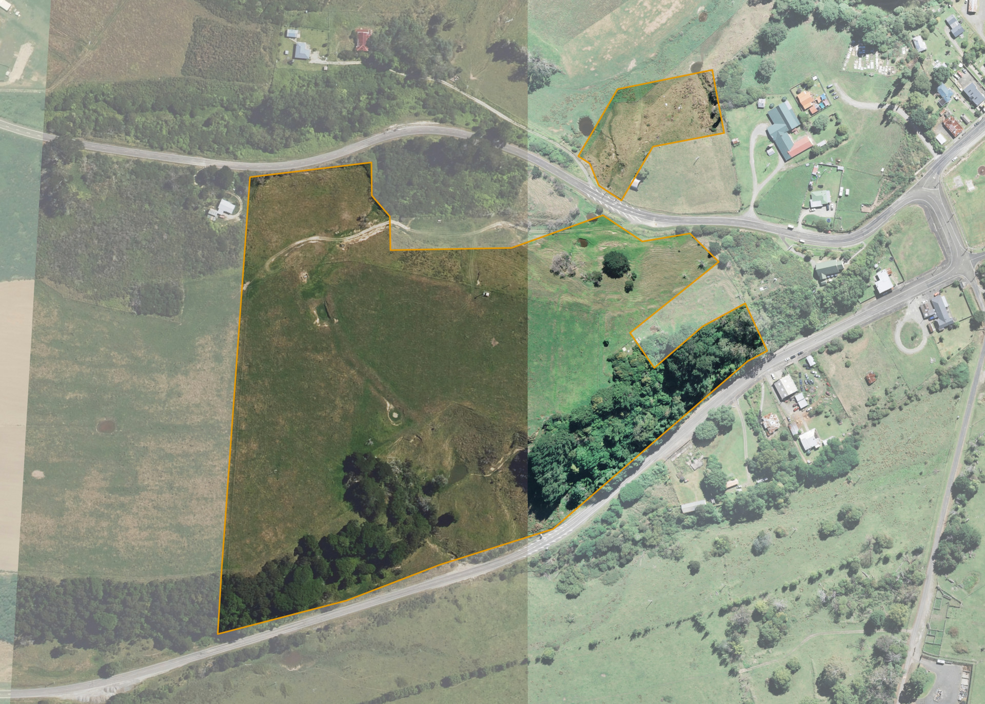
Tikitiki A17B
Tikitiki A17B is a 12.9131 hectare property situated on Te Araroa Road, approximately 100 metres from Tikitiki. The land is flat to medium/steep hill in contour and has a predominant north/south aspect. The block is landlocked.
Soils on the property comprise of Matakaoa Sandy Loam.
The effective area, approximately 8.9 hectares, is currently unutilised but has previously been used for sheep and beef finishing. The balance of the land can be attributed to bush and scrub.
An urupa and the Tikitiki Church is situated on the eastern boundary.
Land Information
- Land area:
- 12.9131 hectares
- Location:
- State Highway 35, Tikitiki
- Region:
- Gisborne
- Māori Land Court region:
- Tairawhiti
- Role of Māori Trustee for this whenua:
- Responsible Trustee
Learn more about the role of the Māori Trustee.
Owner Information
There are 117 people or whānau trusts who have shares in Tikitiki A17B.
Find individual owners or whānau trusts for this whenua
Tip: Search by first name
If you have a question about this whenua or you want to update your details please contact us.
Find out about upcoming owner hui for this whenuaStay connected with My Whenua
My Whenua is our online service for owners, trustees, whānau and those with a connection to whenua we look after on their behalf.
It’s a way to stay up to date with information about your whenua, including:
- Maps and photos
- Owner reports
- A list of owners
- Minutes of owner hui, and more.