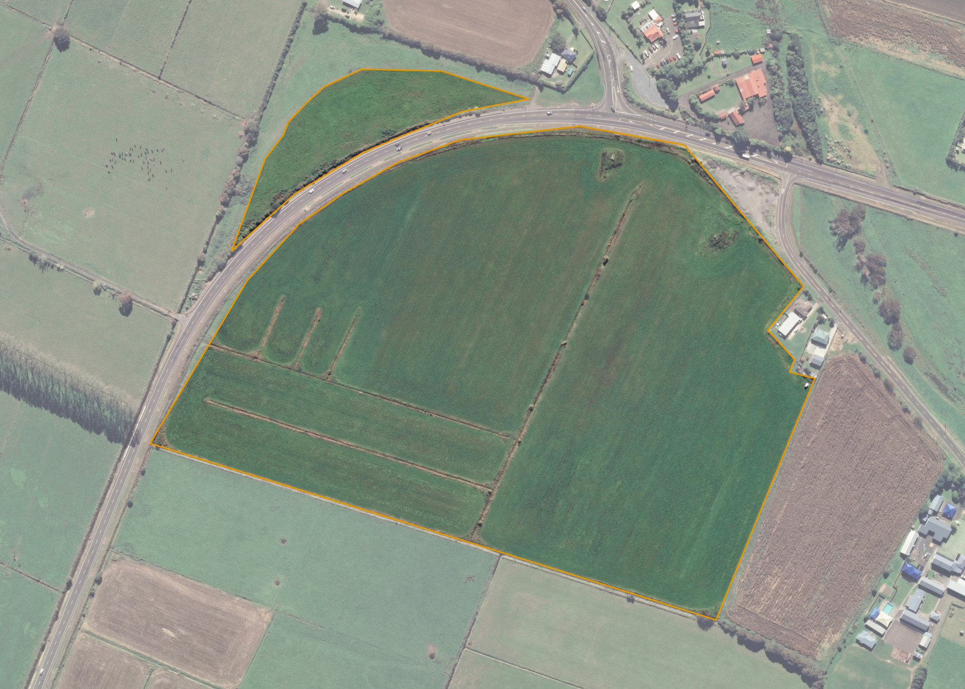
Rangitaiki 29B2C
Rangitaiki 29B2C is an 18.87 hectare property situated on State Highway 30, some 4km from Whakatane and access is off the southern side of State Highway 30.
The block is irregular in shape and level in contour.
Rangitaiki 29B2C is utilised for cropping purposes.
Land Information
- Land area:
- 18.8477 hectares
- Location:
- State Highway 30, Whakatane
- Region:
- Bay of Plenty
- Māori Land Court region:
- Waiariki
- Role of Māori Trustee for this whenua:
- Custodian Trustee
Learn more about the role of the Māori Trustee.
Owner Information
There are 27 people or whānau trusts who have shares in Rangitaiki 29B2C.
Find individual owners or whānau trusts for this whenua
Tip: Search by first name
If you have a question about this whenua or you want to update your details please contact us.
Find out about upcoming owner hui for this whenuaStay connected with My Whenua
My Whenua is our online service for owners, trustees, whānau and those with a connection to whenua we look after on their behalf.
It’s a way to stay up to date with information about your whenua, including:
- Maps and photos
- Owner reports
- A list of owners
- Minutes of owner hui, and more.