Reu Reu 1 Sub 26 B3
Reu Reu 1 Sub 26 B3 is a 20.5782 hectare property situated on the western side of Reu Reu Road, some 14kms north of Halcombe and 26 kms from Feilding.
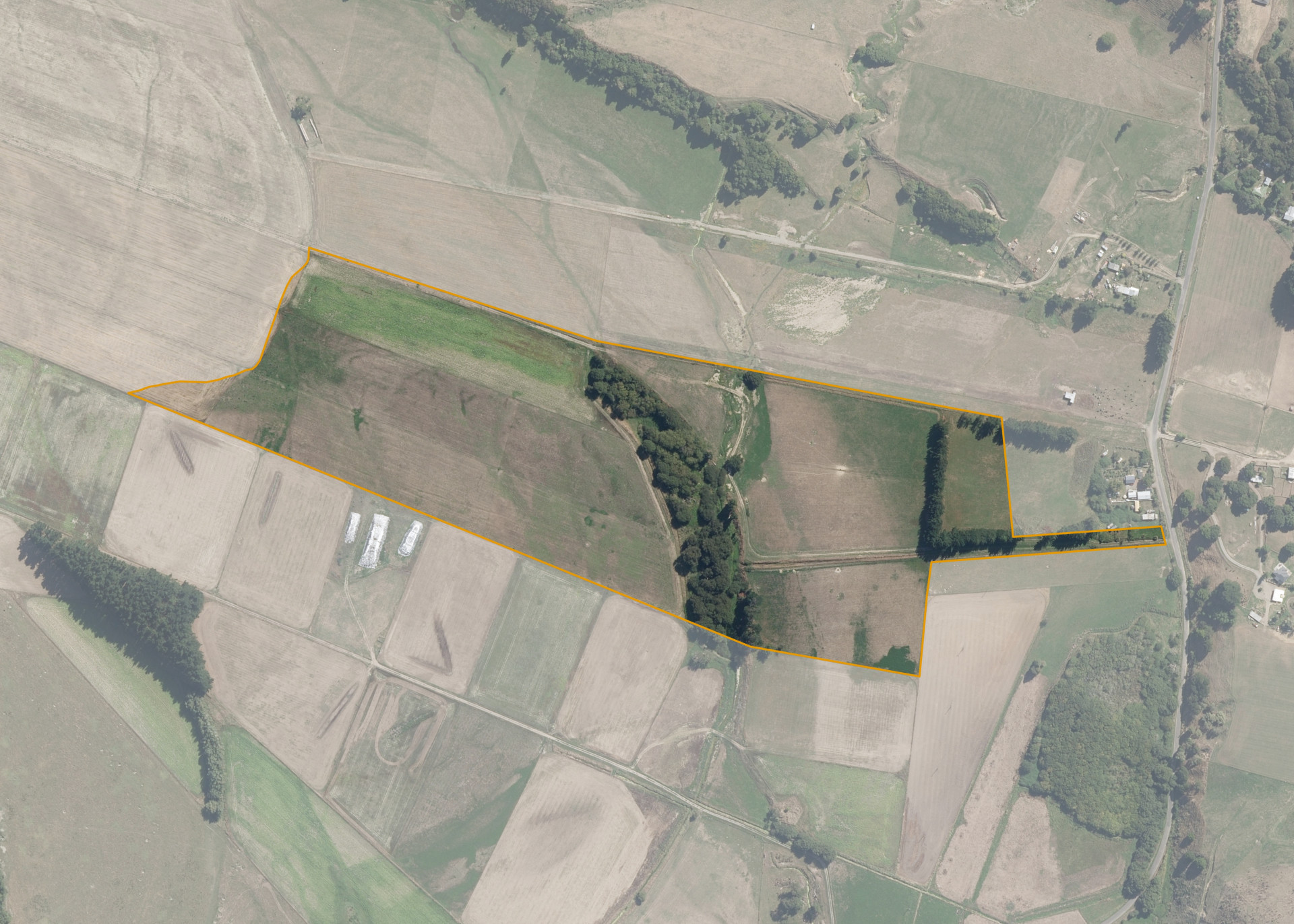
The block is mainly flat in contour and positioned over two terraces. The terraces are dissected by a water course/swampy area.
The property has no predominant aspect, however being low lying it is reasonably sheltered. The property has an effective area, some 15.83 hectares, which is utilised for cropping and stock grazing. The ineffective 3.7682 hectares, can be attributed to drains, creeks, water courses and an area of low land that is flooded and covered in willow trees.
Soils on the property comprise of Ohakea series and Manawatu silt loam/sandy silt loam.
Land Information
- Land area:
- 20.5782 hectares
- Location:
- 439 Reu Reu Road, Halcombe
- Region:
- Manawatu / Whanganui
- Māori Land Court region:
- Aotea
- Role of Māori Trustee for this whenua:
- Responsible Trustee
Learn more about the role of the Māori Trustee.
Owner Information
There are 88 people or whānau trusts who have shares in Reu Reu 1 Sub 26 B3.
Find individual owners or whānau trusts for this whenua
Tip: Search by first name
If you have a question about this whenua or you want to update your details please contact us.
Find out about upcoming owner hui for this whenuaStay connected with My Whenua
My Whenua is our online service for owners, trustees, whānau and those with a connection to whenua we look after on their behalf.
It’s a way to stay up to date with information about your whenua, including:
- Maps and photos
- Owner reports
- A list of owners
- Minutes of owner hui, and more.