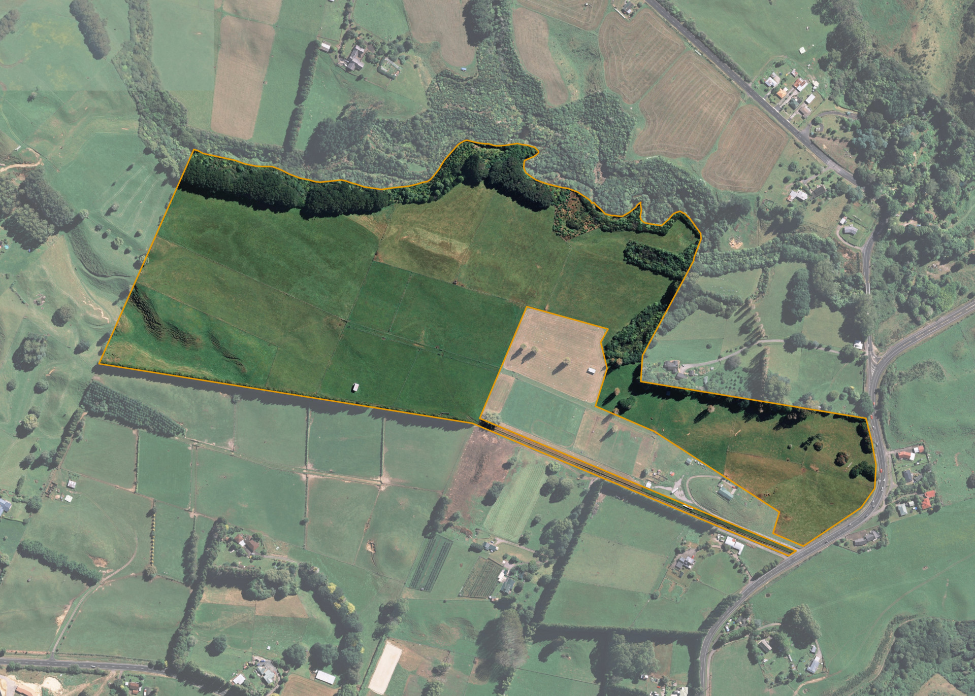
Mangorewa Kaharoa Sec 17
Mangorewa Kaharoa Sec 17 is a 24.6 hectare irregular shaped property situated to the west side of Hamurana Road, some 3km northeast of Ngongotaha and 10km from Rotorua. Access is gained via a narrow strip immediately south of 221C Hamurana Road.
The block is predominately undulating to rolling with a small area of moderate-steep contour.
Mangorewa Kaharoa Sec 17 is utilised for dairy purposes.
Land Information
- Land area:
- 25.116 hectares
- Location:
- Hamurana Road, Hamurana
- Region:
- Bay of Plenty
- Māori Land Court region:
- Waiariki
- Role of Māori Trustee for this whenua:
- Custodian Trustee
Learn more about the role of the Māori Trustee.
Owner Information
There are 77 people or whānau trusts who have shares in Mangorewa Kaharoa Sec 17.
Find individual owners or whānau trusts for this whenua
Tip: Search by first name
If you have a question about this whenua or you want to update your details please contact us.
Find out about upcoming owner hui for this whenuaStay connected with My Whenua
My Whenua is our online service for owners, trustees, whānau and those with a connection to whenua we look after on their behalf.
It’s a way to stay up to date with information about your whenua, including:
- Maps and photos
- Owner reports
- A list of owners
- Minutes of owner hui, and more.