Puhunga A1B2B3B2
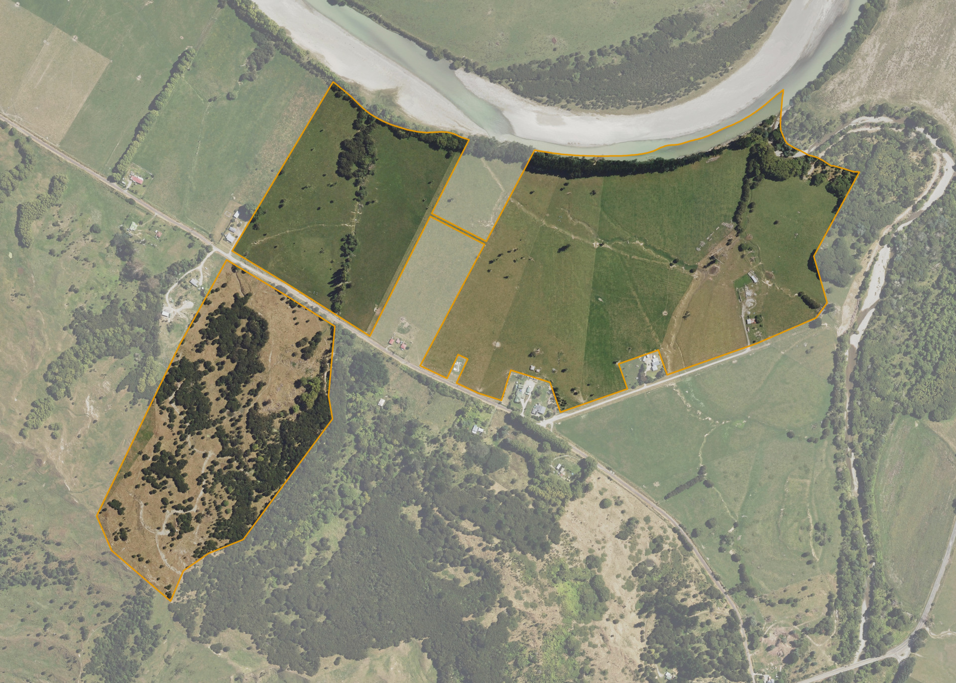
Puhunga A1B2B3B2 is a 56.30 hectare property situated on Puhunga Road and Makatoke Road, approximately 8 kilometres from Ruatoria. The land ranges from flat to medium hill in contour and is dissected into two severances. The southern severance is located on the south side of Puhunga Road. The northern severance is split in to two and is linked by an access way. The block can be accessed from Puhunga Road and Makatoke Road.
The effective area, approximately 55 hectares, is currently utilised for sheep and beef fattening. The balance of the land can be attributed to river erosion.
There is an old dwelling, a cowshed, three implement sheds and two sets of cattle yards on the property.
Land Information
- Land area:
- 56.3001 hectares
- Location:
- Puhunga Rd, Ruatoria
- Region:
- Gisborne
- Māori Land Court region:
- Tairawhiti
- Role of Māori Trustee for this whenua:
- Responsible Trustee
Learn more about the role of the Māori Trustee.
Owner Information
There are 232 people or whānau trusts who have shares in Puhunga A1B2B3B2.
Find individual owners or whānau trusts for this whenua
Tip: Search by first name
If you have a question about this whenua or you want to update your details please contact us.
Find out about upcoming owner hui for this whenuaStay connected with My Whenua
My Whenua is our online service for owners, trustees, whānau and those with a connection to whenua we look after on their behalf.
It’s a way to stay up to date with information about your whenua, including:
- Maps and photos
- Owner reports
- A list of owners
- Minutes of owner hui, and more.