Whangamarino 512A2
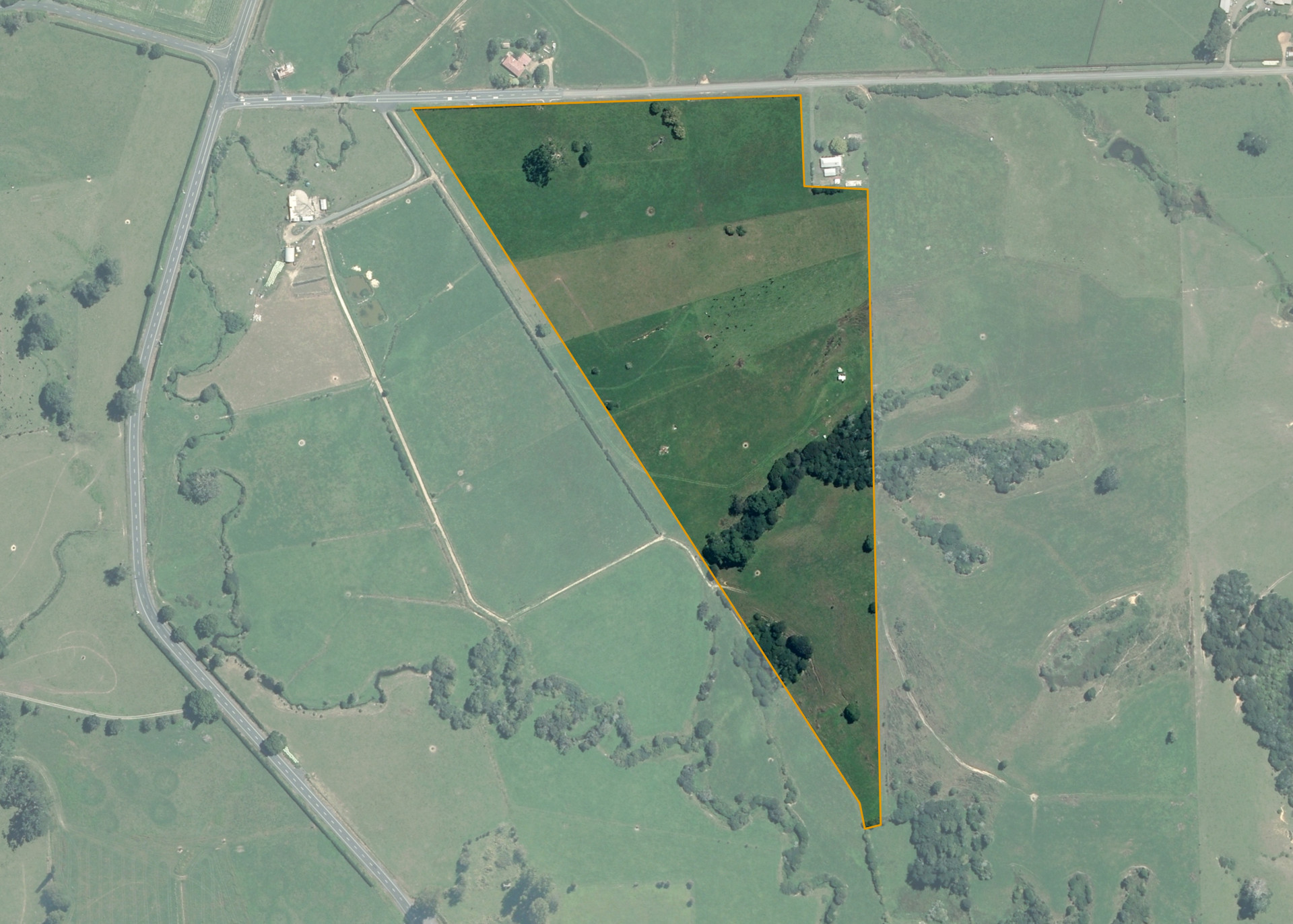
Whangamarino 512A2 is a 12.67 hectare property situated on Jamieson Road, Okaeri, approximately 18 kilometres from Te Kauwhata. The land is flat to easy rolling in contour rising to stronger land to the southern end of the property. Soils on the property comprise of Mangawheau sandy clay loam and sandy loam hill soil. The block can be accessed from Jamieson Road, with the primary access down the side of the property (western boundary) utilising a paper road.
The effective area, approximately 11.9 hectares, is currently utilised for maize cropping. The balance of the land can be attributed to scattered bush.
Land Information
- Land area:
- 12.679 hectares
- Location:
- Opposite 29 Jamieson Road, Waerenga
- Region:
- Waikato
- Māori Land Court region:
- Waikato Maniapoto
- Role of Māori Trustee for this whenua:
- Responsible Trustee
Learn more about the role of the Māori Trustee.
Owner Information
There are 76 people or whānau trusts who have shares in Whangamarino 512A2.
Find individual owners or whānau trusts for this whenua
Tip: Search by first name
If you have a question about this whenua or you want to update your details please contact us.
Find out about upcoming owner hui for this whenuaStay connected with My Whenua
My Whenua is our online service for owners, trustees, whānau and those with a connection to whenua we look after on their behalf.
It’s a way to stay up to date with information about your whenua, including:
- Maps and photos
- Owner reports
- A list of owners
- Minutes of owner hui, and more.