
Tikitere C
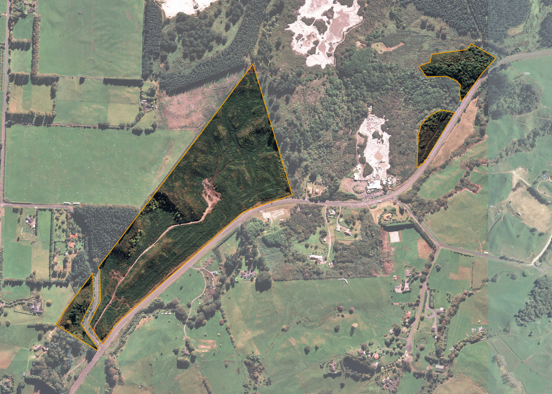
Tikitere C is a 21.9254 hectare block situated on State Highway 30, Tikitere. The block is adjacent to Hells Gate, an active geothermal attraction park.
The land comprises 4 severances. The main severance of 18.1726 hectares held under trust and three small severances which are Maori Reservations.
The reservations are 1.6885 ha, 1.1085 ha and .9558 ha. Two sit to the east of Hell's Gate and west of SH30, up the rise to the top of the hill. The third sits to the west of Te Puea Road turnoff of SH 30.
The main Tikitere C severance is currently utilised for forestry purposes.
Land Information
- Land area:
- 21.9254 hectares
- Location:
- SH 30, Tikitere
- Region:
- Bay of Plenty
- Māori Land Court region:
- Waiariki
- Role of Māori Trustee for this whenua:
- Responsible Trustee
Learn more about the role of the Māori Trustee.
Owner Information
There are 499 people or whānau trusts who have shares in Tikitere C.
Find individual owners or whānau trusts for this whenua
Tip: Search by first name
If you have a question about this whenua or you want to update your details please contact us.
Find out about upcoming owner hui for this whenuaStay connected with My Whenua
My Whenua is our online service for owners, trustees, whānau and those with a connection to whenua we look after on their behalf.
It’s a way to stay up to date with information about your whenua, including:
- Maps and photos
- Owner reports
- A list of owners
- Minutes of owner hui, and more.