Rangitoto Tuhua 67B 4C2
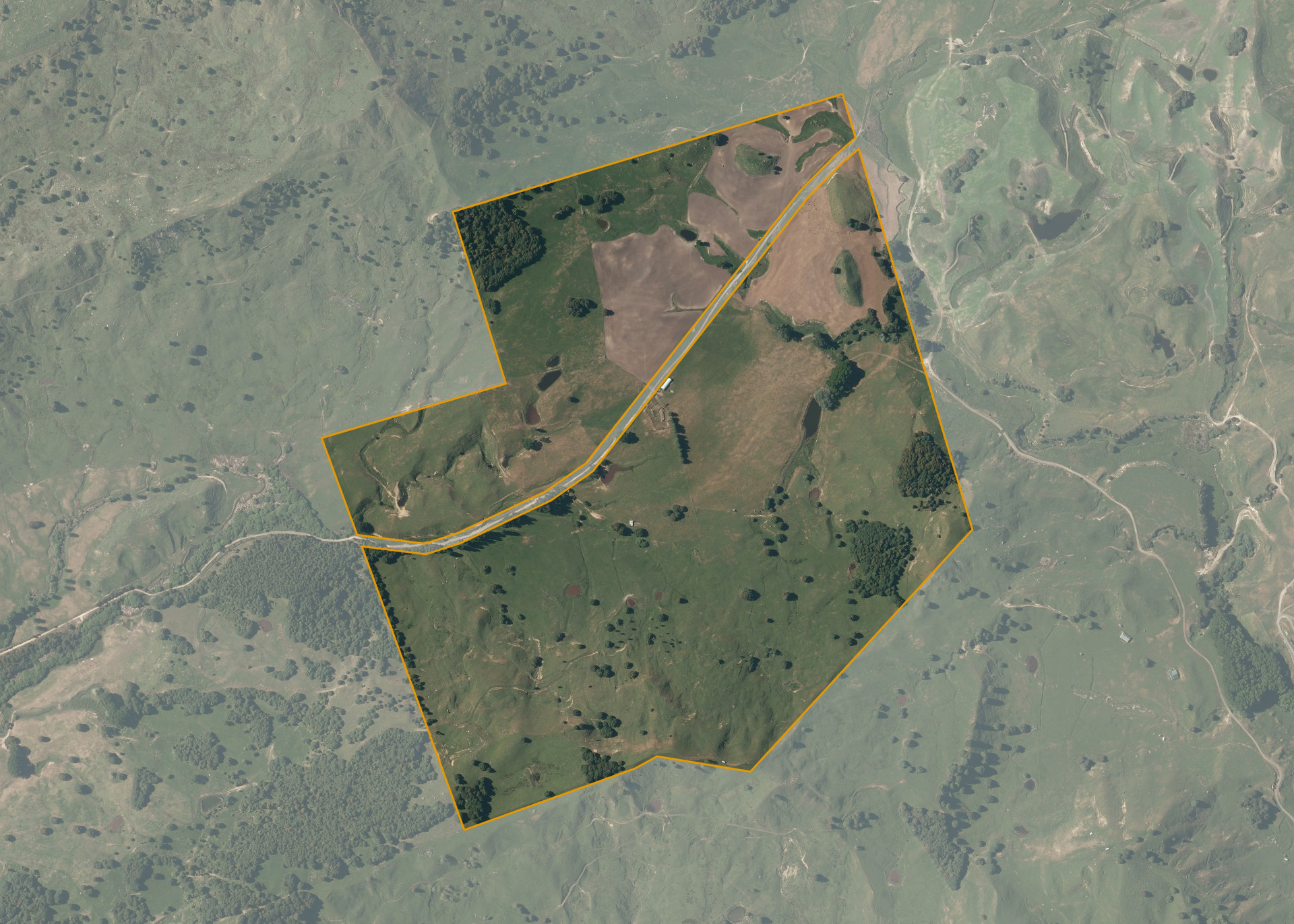
Rangitoto Tuhua 67B 4C2 is a 107.9498 hectare property situated on Waitangi Road in the Taringamotu valley, approximately 16 kilometres north-east from Taumarunui. The land is flat to easy rolling in contour on its northern side and medium steep hillside on the property's southern side. The hillside areas are predominantly of a northern aspect while the flat and easy rolling areas are of an open aspect. Soils on the property comprise of Taumarunui sandy silt and Pakarae sandy loam hill soil.
The effective area, approximately 105 hectares, is currently utilised for sheep and cattle grazing. The balance of the land can be attributed to areas of light bush.
There is a Half Round Hay barn, a set of sheep yards and cattle yards on the property. There is also an old hay barn cowshed on the property that is in derelict condition.
Land Information
- Land area:
- 107.95 hectares
- Location:
- Waitangi Road, Ngapuke
- Region:
- Manawatu / Whanganui
- Māori Land Court region:
- Aotea
- Role of Māori Trustee for this whenua:
- Responsible Trustee
Learn more about the role of the Māori Trustee.
Owner Information
There are 293 people or whānau trusts who have shares in Rangitoto Tuhua 67B 4C2.
Find individual owners or whānau trusts for this whenua
Tip: Search by first name
If you have a question about this whenua or you want to update your details please contact us.
Find out about upcoming owner hui for this whenuaStay connected with My Whenua
My Whenua is our online service for owners, trustees, whānau and those with a connection to whenua we look after on their behalf.
It’s a way to stay up to date with information about your whenua, including:
- Maps and photos
- Owner reports
- A list of owners
- Minutes of owner hui, and more.