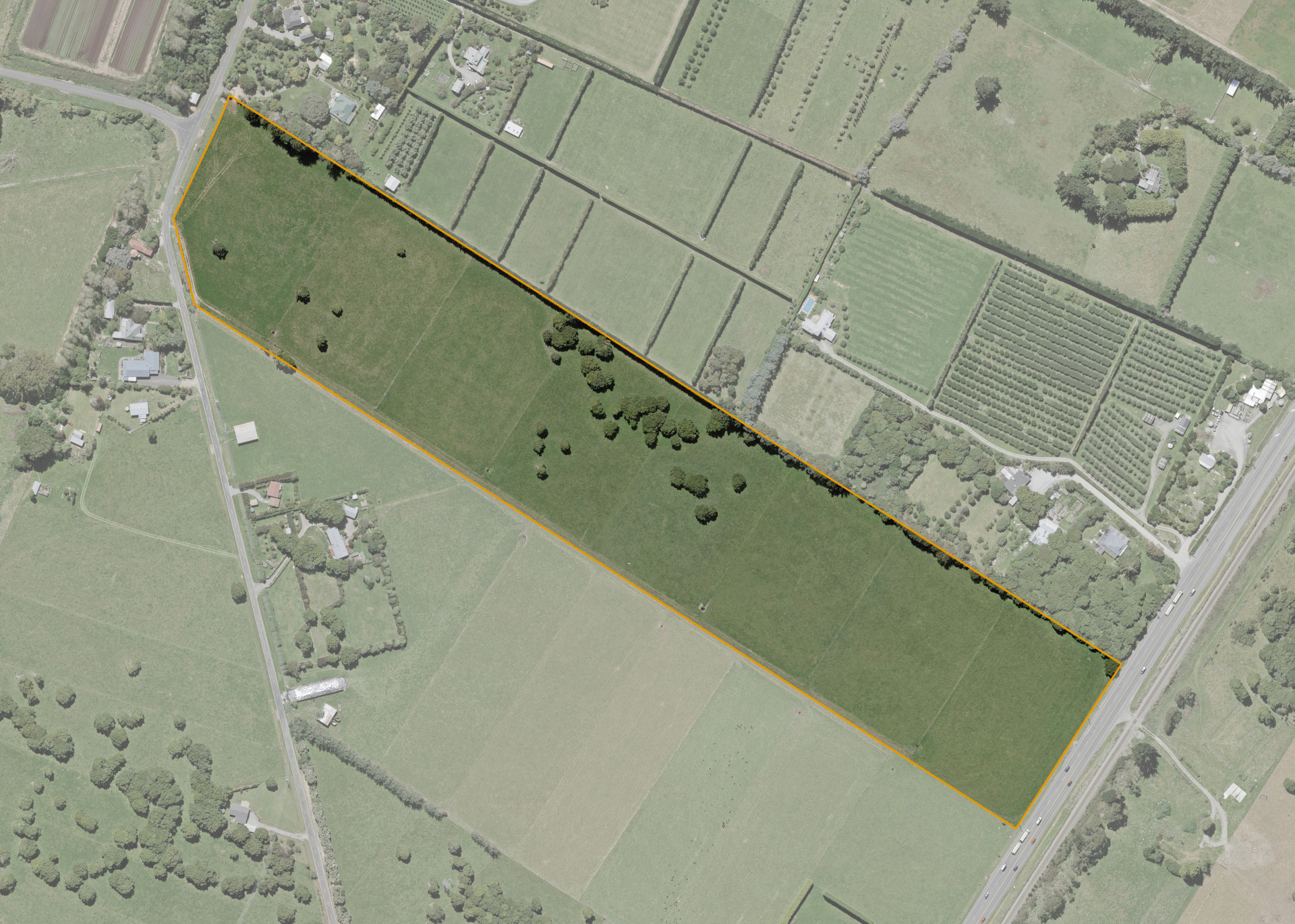
Ngakaroro 3D1 3B
Ngakaroro 3D1 3B is a 10.3456 hectare property situated on the eastern side of Te Waka Road in Te Horo about 6 kilometres south of Otaki. There is vehicle access to the block from Te Waka Road.
Ngakaroro 3D1 3B is a flat piece of land that runs east from Te Waka to bound State Highway One at its back or eastern boundary. The soils comprise Takapau stony loam.
The effective area, some 10 hectares, is currently utilised for dairying in conjunction with the lessee's adjoining farm. The balance of the land can be attributed to the retired Totara trees on the property.
Land Information
- Land area:
- 10.3465 hectares
- Location:
- State Highway One, Otaki
- Region:
- Wellington Region
- Māori Land Court region:
- Aotea
- Role of Māori Trustee for this whenua:
- Responsible Trustee
Learn more about the role of the Māori Trustee.
Owner Information
There are 349 people or whānau trusts who have shares in Ngakaroro 3D1 3B.
Find individual owners or whānau trusts for this whenua
Tip: Search by first name
If you have a question about this whenua or you want to update your details please contact us.
Find out about upcoming owner hui for this whenuaStay connected with My Whenua
My Whenua is our online service for owners, trustees, whānau and those with a connection to whenua we look after on their behalf.
It’s a way to stay up to date with information about your whenua, including:
- Maps and photos
- Owner reports
- A list of owners
- Minutes of owner hui, and more.